Disclaimer: Any views expressed by individuals and organisations are their own and do not in any way represent the views of The Heritage Portal. If you find any mistakes or historical inaccuracies, please contact the editor.
Driving through the Karoo town of Graaff-Reinet as a tourist, the dam wall just north of town does not seem worthy of attention, yet a number of historical photographs recently collated confirms the significance of this engineering project which took just short of five years to complete (between 1920 and 1925).
Through the efforts of a civil engineer, Johannes Haarhoff, who happens to have retired in Graaff-Reinet, three photographic collections were combined and diligently analysed and interpreted, resulting in the splendid end result – a book published on behalf of the Graaff-Reinet Museum – already colloquially referred to as “the dam book”. This was an assignment right up his alley considering his academic interest in engineering projects relating to water.
The three photographic collections he relied on in providing the combined historical narrative were:
- Graaff-Reinet Museum Photographic Digital Collection;
- Hardijzer Photographic Research Collection;
- Johan Loock – photo album in private collection.
The end product is a publication of 56 pages containing 83 historical images with accompanying text presenting a detailed historical visual narrative of the dam wall under construction.
The intention of this article is not only to create awareness of the above publication but also to provide a condensed historical narrative, with some images from the same publication included. See details of how to go about ordering this publication at the end of this article.
The dam is located at the convergence of four rivers (some intermittent), namely the Sundays River (or Nukakamma), Gatsrivier, Pienaarsrivier and Broederstroom. Located in the Camdeboo National Park, the dam has a catchment area of 3800 square kilometres with a storage capacity of 80 million cubic metres covering 1133 hectares when at its fullest.
The significance of the dam in the area is emphasised by a local anecdote, which more or less goes as follows:
During the early 1970’s a group of three or four ladies travelled from Graaff-Reinet to go and do their annual clothing shopping in the Cape Town metropole. They travelled down in one vehicle. Somewhere closer to Cape Town the ladies were pulled over by a traffic official. Anxiously the driver stops - thinking that she had unknowingly committed a road transgression. The traffic official walked up to the car and to the utter amazement of the ladies asked the driver of the vehicle in an excited tone: “Tannie, wat is die stand van die dam?!” (Auntie – what is the current water level of the dam?).
The officer, who clearly originated from Graaff-Reinet, saw the registration number and purely stopped the ladies to satisfy his curiosity about the dam level – no other reason.
This little interaction alone confirms the social and economic significance of the Van Ryneveld’s Pass dam to the Graaff-Reinet community – then and now.
It just so happens that the site preparation for the building of the dam wall was completed 100 years ago (June 1921). The final opening of the dam wall took place on 14 July 1925, 139 years after the establishment of the town. The town, established during 1786, happens to be the fourth oldest magistrate district in South Africa.
The commemorative plaque revealed on the day of the opening of the dam wall has since sadly disappeared. Fortunately, a photograph of this plaque has survived, a reproduction of which is also included in the book. The book also contains the brochure which was produced for the opening day. This brochure contains interesting information, such as:
- the dam holds some 79 billion litres of water at full capacity;
- nearly 250 000 bags of cement were used in the dam wall alone;
- around 2200 cubic meters of concrete was poured into the main wall.
Willem Cornelius van Ryneveld, after whom the dam and the pass was initially named, was the appointed Civil Commissioner and Resident Magistrate between 1834 and 1850. His gravestone can be seen in Graaff-Reinet. The original pass was built by Graaff-Reinet resident Andrew Geddes Bain, who later gained legendary status as pass builder in the Cape Colony.
The name of the dam, Van Ryneveld’s pass dam, was changed to Nqweba (Xhosa word meaning: “meeting place”) during 2001.
Although Graaff-Reinet is situated on the banks of the Sundays River, the town has been beset with water problems ever since it was established.
Since the early 1800’s, multiple interventions were implemented to ensure that the town was sufficiently sourced with water diverted from the river a distance upstream.
Growth of the town steadily exceeded the capacity of the canal system established during 1880’s. Following the influx into town of soldiers and farmers from outlying districts along with their workers, an acute water shortage was experienced during the Anglo-Boer War (1899-1902).
Considering that there still was no dam in the immediate area, a more permanent solution was required around water provisioning for both agricultural and domestic use in town.
Building of the dam wall
A detailed survey of the dam site took place during 1918 followed by the proclamation of the Van Ryneveld’s Pass Irrigation District during 1919.
The dam wall construction eventually started during late 1920 with the first construction workers arriving during November of the same year. The site preparation was completed some 8 months later (June 1921). The tedious process of excavations for the dam wall started during July 1921 with the first concrete of the dam wall being poured some 16 months later (November 1922).
At the peak of the construction, 800 workers were accommodated at the construction site camp. The two barracks near the building site alone housed 200 workers each. This number is significant in that the population of Graaff-Reinet at the time was only around 8000 citizens.
Besides construction buildings, housing, roads and water supply, both a small and large concrete mixing plant were constructed on the actual building site.
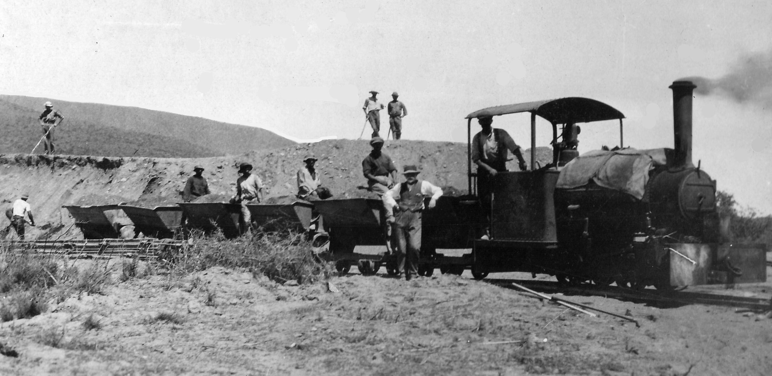
Sand for building the dam wall was gathered from the bed of the Sundays River and transported with small trolleys running on light railway tracks. Both mules and a small industrial Bagnall steam locomotive, shown above, provided the motive power. (Graaff-Reinet Museum)
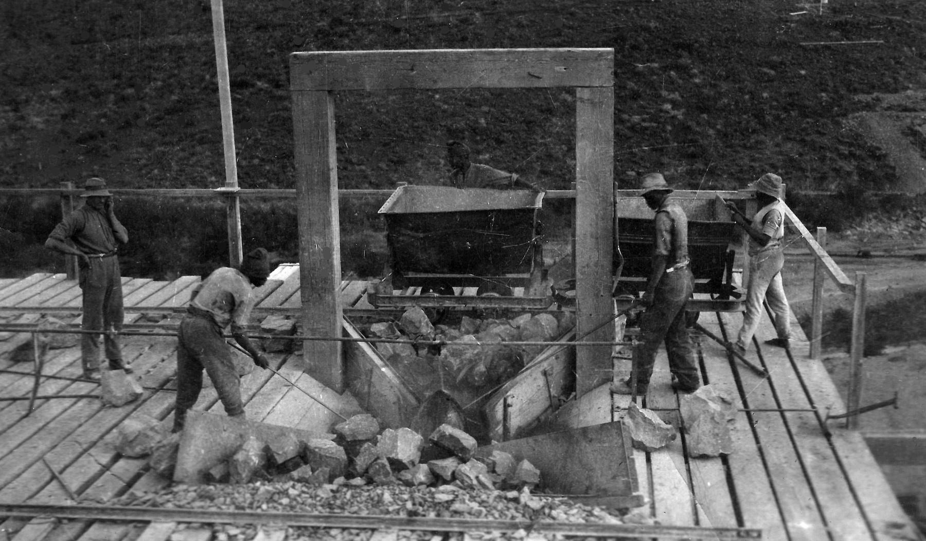
Rock used in the building of the dam wall was obtained from a quarry established at the top of the cliff close to the dam wall. Broken rock extracted from this quarry was then loaded in trolleys and pushed by hand to the top of a crusher plant and discharged into a receiving chute directly above the crusher – as can be seen on this image. The crusher then reduced the large rock fragments to evenly graded rock aggregate which collected again in trolleys at the bottom of the crusher plant and pushed by hand to the concrete mixing plant. (Graaff-Reinet Museum)
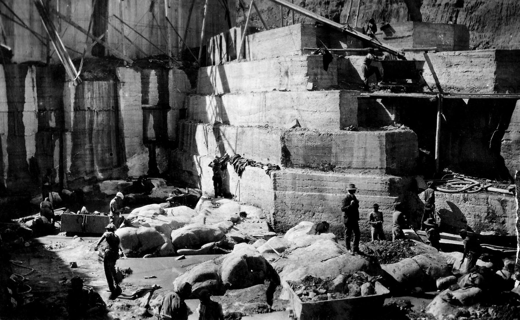
In building the dam wall, excavation proceeded to reach the underlying solid rock – a depth of 13 metres below the river bed. This image shows the start of the construction of the dam wall at foundation level. (Graaff-Reinet Museum)
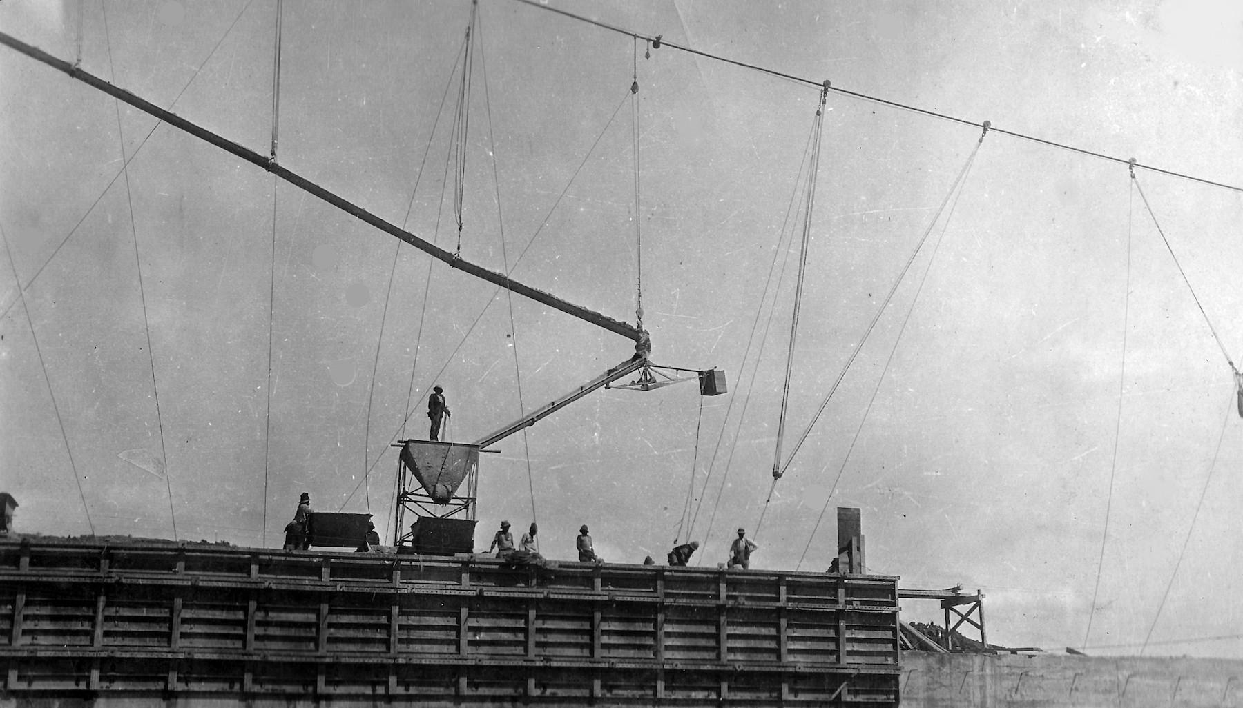
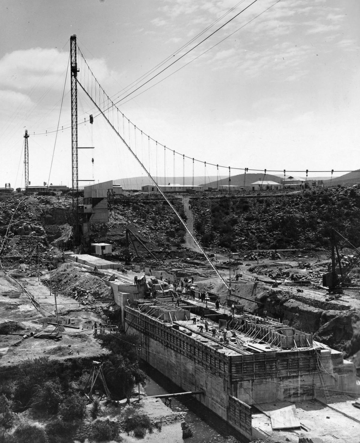
A cable system in use to direct a concrete chute (linked to the concrete tower) to the point where the concrete needed to be discharged. (Graaff-Reinet Museum)
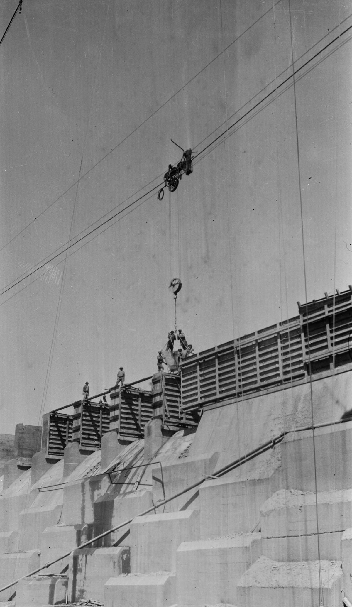
Another mode used in transporting concrete was to run concrete buckets via an aerial cableway to the point of discharge - as can be seen on this image. The same cable system was also used in placing large boulders in the dam wall to save on concrete. (Carol Hardijzer)
After a full year of concreting, the dam wall reached river bed level during November 1923. This image also clearly shows the cabling systems in use to transport the concrete. (Graaff-Reinet Museum)
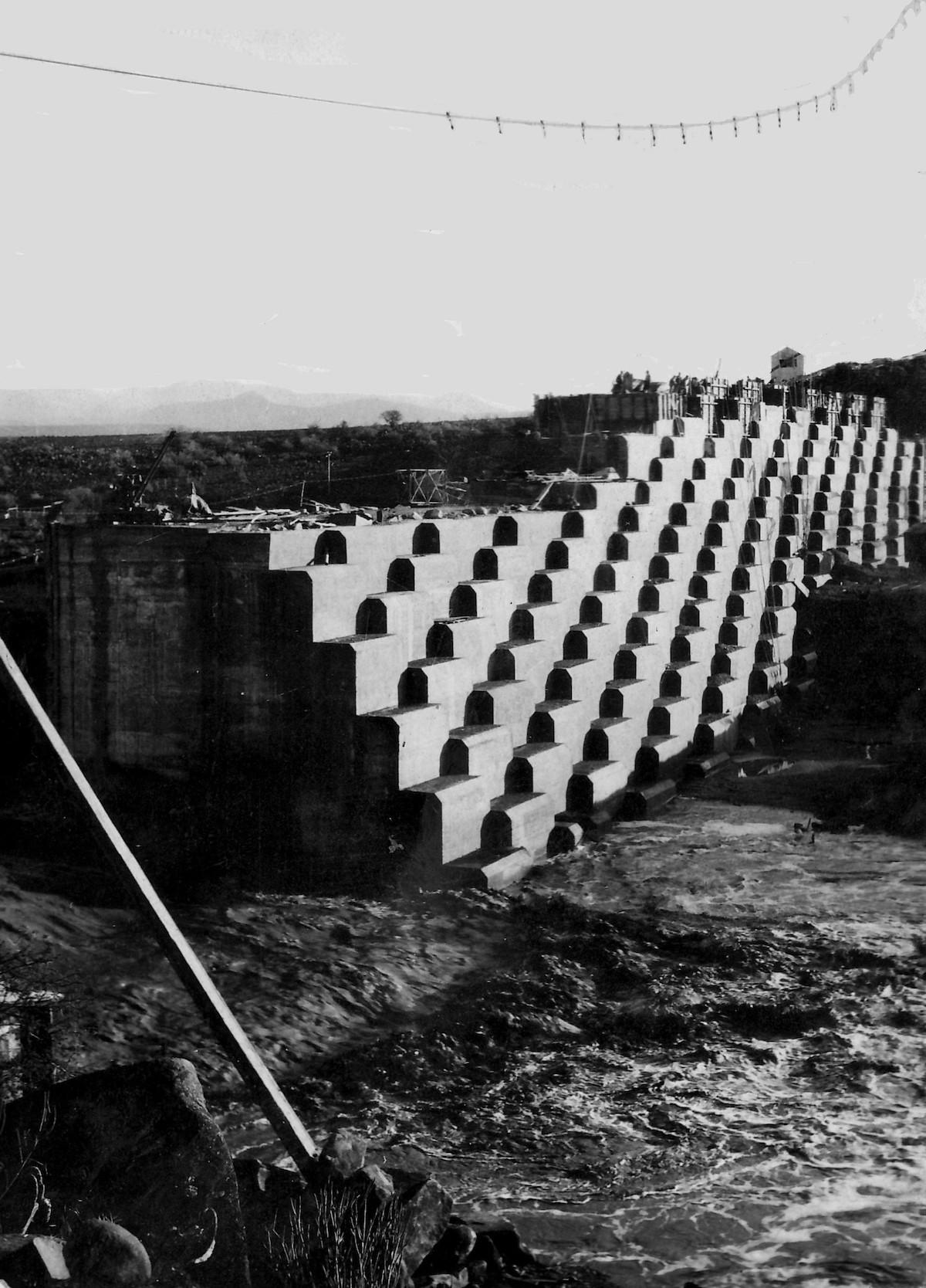
To allow the river to flow whilst the wall was under construction, a gap was left in the wall. Just prior to closing the gap, the Sundays River came down in flood during March 1924. This image also clearly shows the characteristic steps. The purpose of these steps is to dissipate the energy of the water when the dam overflows. (Graaff-Reinet Museum)
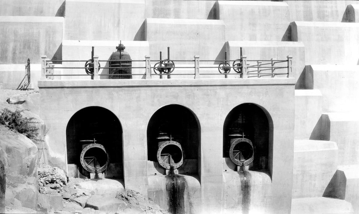
Although no longer in use, three large desludging outlets were also included in the construction of the dam wall. On the upstream side (opposite side from this image), the outlets had grids to prevent their blocking by suspended debris. As can be seen on the image, each of these outlets was regulated from a gallery just above. (Carol Hardijzer)
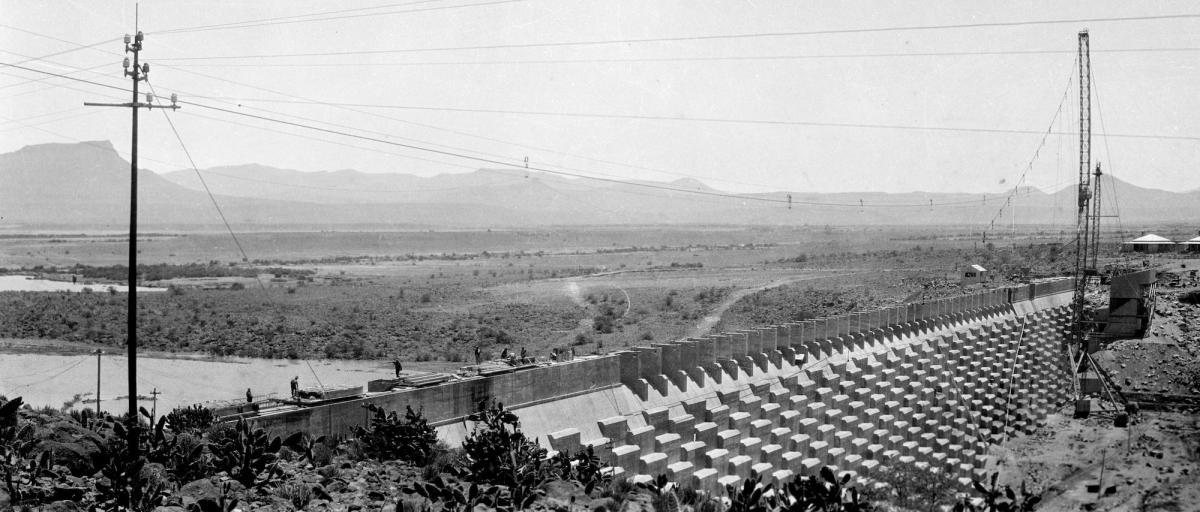
The walkway above the overflow of the completed dam wall. The floor slab and safety rails of the walkway were constructed with prefabricated concrete components manufactured on site. About 20 lamp posts were also installed over the full length of the dam wall. They were removed in later years, but some had fortunately been retained and reinstalled in Graaff-Reinet’s historic Parsonage Street. (Carol Hardijzer)
Downstream water distribution
The farming community at Kendrew, some 25 kilometres from Graaff-Reinet, was the main agricultural beneficiary of the dam wall project.
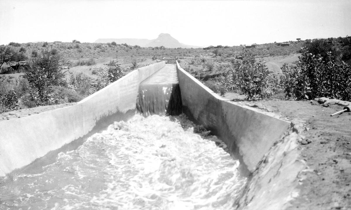
The dam wall construction team was also responsible for building the downriver distribution system to take water to the village of Adendorp and the areas with irrigation potential between Graaff-Reinet and Kendrew – all via a canal system. A large project in itself, this arm of the project accounted for some 20% of the total dam construction costs.
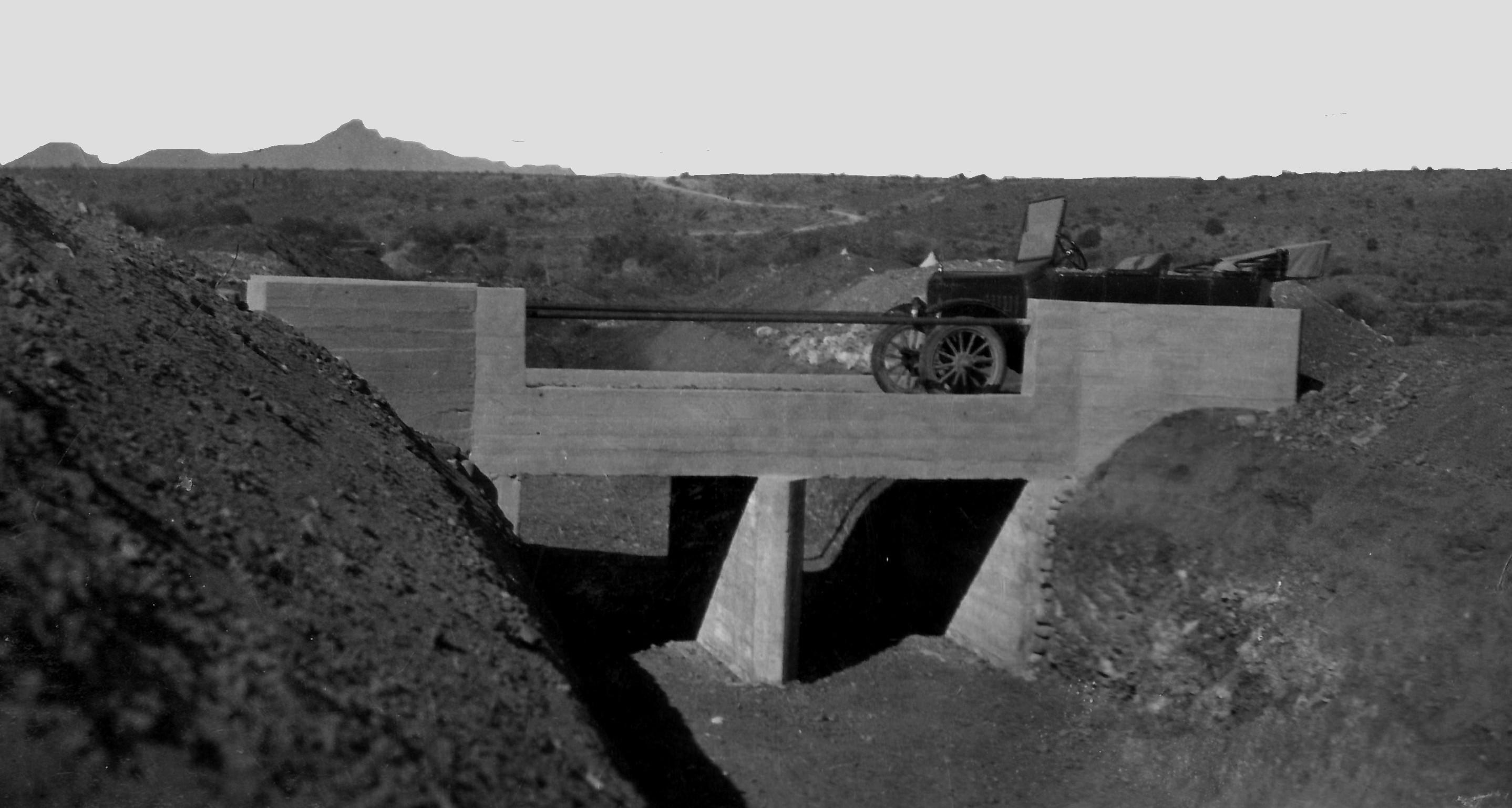
The canals had to overcome topographical features, such as steep terrain and natural watercourses and man-made obstacles in the form of roads and the railway line. Small road bridges had to be provided to accommodate farm and other minor roads.
Most of the canal system was left unlined after careful excavation – only steep sections had to be lined with concrete.
Few photographs exist of the downstream development making the images contained in the book unique.
The dam wall construction team was also responsible for overseeing the downriver distribution system. This system consisted of three main canals. (Carol Hardijzer)
In constructing the canal system, provision also had to be made for small road bridges in order to accommodate farm and other minor roads. (Graaff-Reinet Museum)
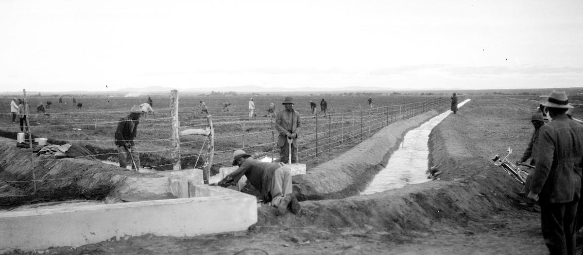
Part of the dam wall project was that provision had to be made of the controlled release of water. Water had to be released into the river to flow downstream for agricultural use in Kendrew. In this image, the chap on his knees seems to be operating a sluice gate. (Carol Hardijzer)
Dam water levels
Just prior to the completion of the dam wall (1924/25), whilst the support piers of the walkway were being constructed, the dam overflowed.
Following the 1925 opening ceremony, the dam level attained an average of 44% of its capacity during 1928. During the years coinciding with the worldwide economic depression, a severe drought followed resulting in the level of the dam dropping progressively holding an average 26% of full capacity during 1929, 22% during 1930 and 16% during 1931.
Official records indicate that the dam was completely empty during December 1930. Six-and-a-half years after its official opening (July 1925), the dam wall overflowed for the first time during January 1932.
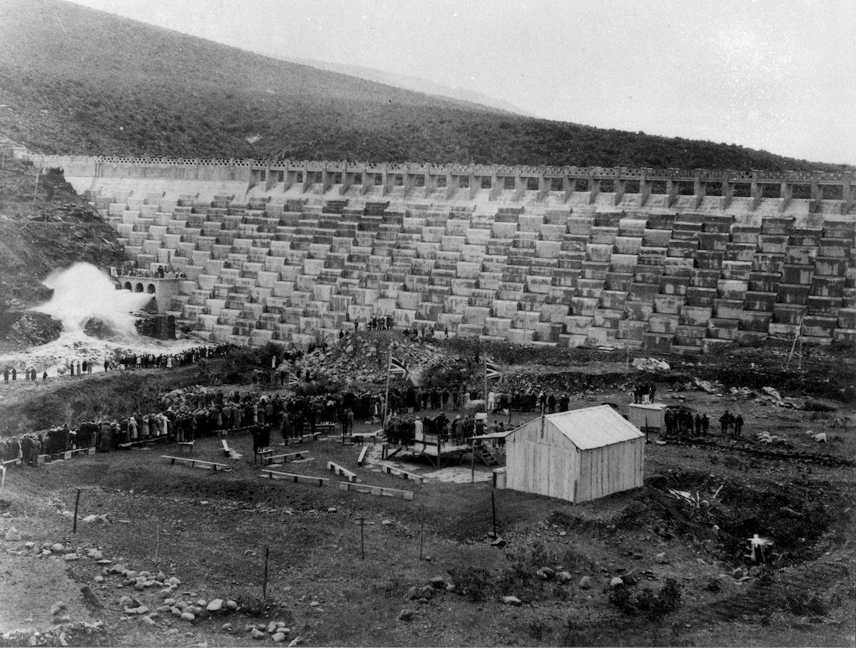
Dam wall opening ceremony – 14 July 1925. The photo shows dignitaries on a stage, who with the guests of the day observe the spectacular spray of water after the outlets were opened for dramatic effect. Also note the men standing on the smaller building structure on the right in order to get a better view. (Graaff-Reinet Museum)
Producers of the photographs
The existence of the various photographic collections on the building of the dam wall suggests that a number of photographers would have photographed the construction activities at the time.
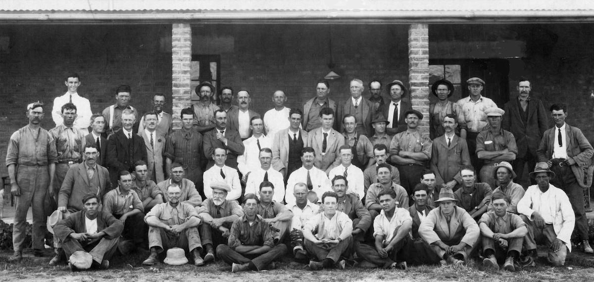
Sadly, little is known about the photographers who produced the images. The names of only 2 photographers have been recorded, namely that of William Roe (photographs captured prior to the dam wall being built) and JC Powels who captured a group photo of staff who worked on the project.
It is not known whether the photographers at the time were appointed by a town council or irrigation board publicity department to capture images as the dam wall entered different phases for prosperity purposes or, whether the photographs were captured by professional photographers for commercial purposes (if this was so, then more images would have been found in private collections) or, whether it was simply an amateur photographer (or two) that went around capturing images of the engineering works in progress.
The quality of the images however indicates that the end results were that of professionally appointed photographers. It is therefore suggested that the images were captured by formally appointed professional photographers.
Senior construction staff surrounded by part of the construction workforce. The 14 senior staff are - far left, at the back is W Pullen (draughtsman). Standing in the row in front of him 3rd from left RJ Brown (correspondence clerk), 4th from left EC Powell (compound manager), 5th from left J Wilson (clerk), 6th from left WJ Pike (mechanical foreman), 7th from left BT Ben (works foreman), 8th from left JRW Johnson (accountant), 9th from left EC Blom (storekeeper), 10th from left WJ du Toit (timekeeper). In front of them seated on chairs (in white shirts): 1st on left W Maclaren (assistant engineer), 2nd from left LA MacKenzie (assistant engineer), 3rd from left KR Shand (resident engineer), 4th from left HR Roberts (assistant engineer) and next to him (with jacket) J Claassens (assistant engineer). Photograph by JC Powels
Main image: Dam wall construction nearing completion. The dam wall has a triangular cross-section, 30 meters at the deepest point, tapering to about 3 meters at the top. This image shows the construction of the walkway above the completed dam in progress
Special acknowledgement: Anziske Kayster from the Graaff-Reinet Museum and Johannes Haarhoff for input provided into this article.
About the author: Carol is passionate about South African Photographica – anything and everything to do with the history of photography. He not only collects anything relating to photography, but also extensively conducts research in this field. He has published a variety of articles on this topic and assisted a publisher and fellow researchers in the field. Of particular interest to Carol are historical South African photographs. He is conducting research on South African based photographers from before 1910. Carol has one of the largest private photographic collections in South Africa.
Ordering the book
The book will be of interest to a broad spectrum of historians, be that town history (Graaff-Reinet), provincial history (Eastern Province), Karoo history, construction or photographic history.
This hardcover book, consisting of 56 pages and 83 historical images, can be ordered directly from the Graaff-Reinet Museum at R300 (postage excluded). The Museum has various postal options available (click here to view).
The book is titled: The construction of the Van Ryneveld’s Pass dam – Graaff-Reinet An annotated selection of historical photographs (Nqweba Dam since 2001)
The museum can be contacted via graaffreinetmuseum@intekom.co.za or on 049 892 3801.
Sources
- Graaff-Reinet Museum (2021). The construction of Van Ryneveld’s Pass Dam – Graaff-Reinet – An annotated selection of historical photographs
- Graaff-Reinet Advertiser (extract October 2021). Looking back: Graaff-Reinet’s Nqweba dam (Graaffreinetadvertiser.com)
- Graaff-Reinet Museum Digital Photograph Collection
- Hardijzer photographic research collection
- Loock, Johan – Photo album in private collection
- Nunn, T. (2008). Graaff-Reinet – An illustrated historical guide. Westby Nunn. Western Cape
Comments will load below. If for any reason none appear click here for some troubleshooting tips. If you would like to post a comment and need instructions click here.

