In the wonderful article below, well known Joburg enthusiast Lucille Davie explores the various streams and rivers of the city and traces their journeys as they flow away from the continental watershed. The piece was first published on the City of Johannesburg's website on 24 December 2004. Click here to read more of Davie's work.
Joburg shares the distinction of not being built on a river or harbour with one other major city in the world - Birmingham in England. But that doesn't mean the city doesn't have any water. Far from it. A number of streams meander through the suburbs, and form the source of two of southern Africa's mightiest rivers - the Limpopo and the Orange.
If you look closer, you'll see that a myriad of small streams or spruits, trickle through the suburbs, particularly the northern suburbs. Most of the springs from which many of these streams emanate are now covered in concrete and canalised, accounting for the fact that the names of early farms in the area often end with "fontein", meaning "spring" in Afrikaans. Braamfontein, Rietfontein, Zevenfontein, Doornfontein, Zandfontein and Randjesfontein are some examples.
An old beacon that marked the division between three historic Joburg farms (The Heritage Portal)
When the first white settlers reached the area that is now Johannesburg, they would have noticed the glistening rocks on the ridges, running with trickles of water, fed by the streams - giving the area its name, the Witwatersrand, "the ridge of white waters". Another explanation is that the whiteness comes from the quartzite rock, which has a particular sheen to it after rain.
Long stretches of streams have been canalised - the canal at the beginning of Barry Hertzog Avenue contains some beautiful stonework, but in the process the city has lost valuable natural streams.
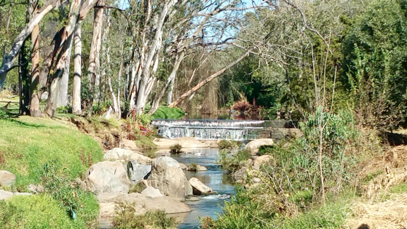
The city's longest and most popular stream, the Braamfontein Spruit ("Braamfontein" means "spring of brambles"), is covered and canalised near its source, but once the river runs out of the Parkview Golf Course, it runs through parkland, right to the edge of the city, so that Joburgers can still enjoy it in its original state. Walkers, runners and cyclists use a path along its banks every weekend.
Braamfontein Spruit just before the Parkview Golf Course (William Gaul)
It's a beautiful river, with waterfalls in places, tumbling over masses of large boulders, and grassy banks, planted with dozens of weeping willows, gum trees and reeds, and just recently, guinea fowl wandering the grassy verges. There are remnants of the city's first white settlements - several finely crafted stone weirs attempt to collect the water, with broken bridges in places.
But there's something of a conundrum concerning the two great rivers, the Orange and the Limpopo. One would think that the water that flowed south out the city would end up in the southern Indian Ocean, and the water that flowed north, in the Atlantic Ocean. But this is not the case.
Johannesburg, particularly the northern suburbs, consists of a series of broken ridges, the most significant of these being the Hillbrow / Linksfield / Roodepoort ridge.
The ridge's significance stems from the fact that it is the watershed ridge - all rain falling south of this ridge will eventually flow into the Atlantic Ocean; and of course, rain falling north of the watershed flows into the Indian Ocean.
Let's look at these streams, and try to understand the complex network of small water ways that converge to form the Limpopo and Orange Rivers.
From the south - the Klip and Vaal
Approaching Johannesburg from the south, the first streams visible are those that form the Klipspruit River, which runs through Soweto and joins the Klip River, which then flows into the Vaal River.
The Klipspruit has several tributaries, one of which begins in the koppies of Lindhaven, just north-west of the Westgate Shopping Centre. This spruit - together with another small stream that begins in the Ross Skinners Park - runs into Princess Dam in Roodepoort.
Another tributary of the Klipspruit begins in the New Canada area, just north of Orlando East, and runs through Nancefield and into the wetlands south of the suburb.
The Klip River meanders through the western areas of Soweto and Lenasia, forming numerous wetlands in the townships, merging with the Klipspruit just beyond Lenasia, before it flows into the Vaal River.
Another river, the Bloubos, reaches the Vaal from the southern suburbs of Johannesburg. The Bloubos Spruit starts in the koppies of Ridgeway, north of Mondeor, and flows into the Klipriversberg Nature Reserve, then meets the Klip as it wanders below Risipark.
The Klip joins the wide Vaal River in the Vereeniging suburb of Three Rivers. The third river to join the Vaal is Suikerbos, which begins life in the Suikerbosrand Nature Reserve, about 100km south east of Johannesburg. The Vaal River also marks the border of Gauteng and the Free State, and by now the water is already on its way to the Atlantic Ocean, flowing out of the Vaal Dam.
The Vaal River, flowing from the east, originally from Mpumalanga, is interrupted by the mighty Vaal Dam, Joburg's water source, some 60km south of the city. This dam was completed in 1938, and is a shallow reservoir of about 300km².
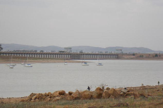
Vaal Dam (Lennie Gouws)
It continues its flow out of the dam at Vereeniging, and meanders towards Parys in the Free State. Then it forms the border between the Free State and the Northern Cape, flows into the Bloemhof Dam, then enters the Northern Cape at Warrenton.
Although we might think of the Vaal River as a large river it is in fact a tributary of the much larger Orange River. The two merge at Douglas in the Northern Cape and from here the river flows west, then north through Upington. In its final stretch it forms the border in the desert with Namibia until reaching the Atlantic Ocean at Alexander Bay.
At the mouth it has completed a journey of around 2 400km, emptying into the sea as a 100m wide river, only filling its one-kilometre wide bed during infrequent floods, most of the water having been lost to evaporation before it reaches the mouth.
To the north - the Jukskei
In 1981 the late Wendy Bodman researched the streams running north of the city, and published a 15-page booklet. Her work was thorough, and is filled with suggestions on how to preserve the natural streams. It is peppered with phrases like: "this is Edenvale's most priceless natural area", "there is wonderful potential here for a natural park and bird sanctuary", or "there is great potential for this stream and before it enters the Jukskei it should be kept natural".
What follows is largely a summary of her research, following the progress of the main streams, into which many other small tributaries flow.
There are several streams rising in the ridges north of the city, which eventually all flow into the Hartebeespoort Dam.
Starting in the east is the Jukskei, which presents another conundrum - it's a north flowing stream but it rises in the south, under Ellis Park. So, what gives? Because of the eastward slope of the land into Bezuidenhout Valley, and because the Kensington ridge curves slightly north into Ellis Park, forming a natural basin, the water can't flow south. It has no choice but to go with the flow of the valley, which will ultimately take it northwards.
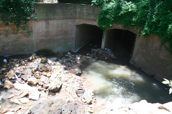
It flows down towards Bruma Lake, then curves around the end of the Linksfield ridge to Gillooly's Farm, heading north east towards Alexandra. The Jukskei flows steadily towards Leeuwkop Prison. It's bolstered by several tributaries along the way - the Edenvale Spruit, the Lyndhurst Stream and the Modderfontein Spruit - meeting with the Braamfontein Spruit just beyond the prison.
The Jukskei river near Alexandra (Lucille Davie)
Sandspruit
The Sandspruit is another stream that flows north. Its origins can be traced to three places. Firstly, the Orange Grove Stream, which starts in the Mountain View ridge, near the corner called "Death Bend" in Louis Botha Avenue.
It flows down to Houghton Drive, and along the edge of the Houghton Golf Course, where it is not visible, having been covered some time back. From here it veers east through Paterson Park and at Melrose North meets with a second, smaller stream that rises somewhere in the vicinity of the Houghton Golf Course, and is buried as it flows through Norwood.
The third stream has two sources: in Pine Avenue near St John's College, emerging again in the Killarney Golf Course, where it is joined by another small stream which probably rises in Oxford Road at Saxonwold, or near to the Johannesburg Zoo, according to Bodman.
These three streams join just north east of the Melrose Bird Sanctuary. Bodman suggests that this could be where the Sandspruit originates, in a concrete channel. Or, she ponders, perhaps it should be called the Sandspruit only once it has emerged from the concrete at Corlett Drive. Her research has failed to reveal exactly where the official Sandspruit begins.
Braamfontein Spruit
Moving further west the next stream is the Braamfontein Spruit, which thankfully, is largely natural, and flows unhindered, with park lands on either side. It is the most popular of the city's rivers, providing residents with a much-needed green lung running through the suburbs. Religious groups use it on Sundays, often for baptism, and in Craighall and the Sandton Field & Study Centre horses are stabled along its banks. They are used for river patrols and leisure activities.
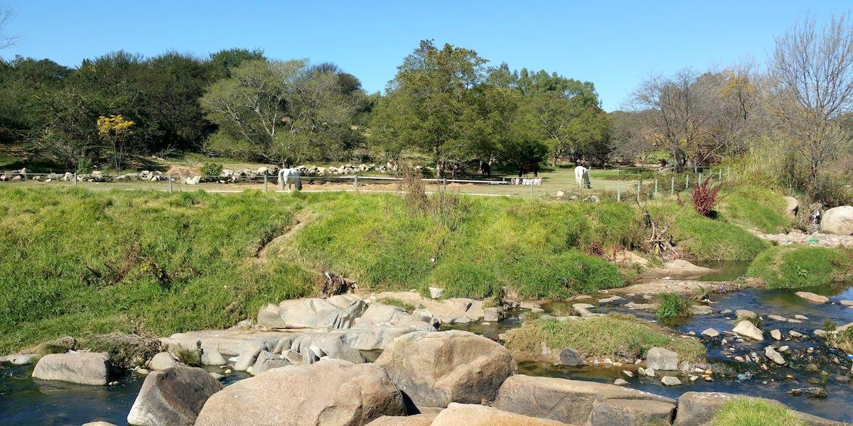
Horses near the Field and Study Centre in Sandton (The Heritage Portal)
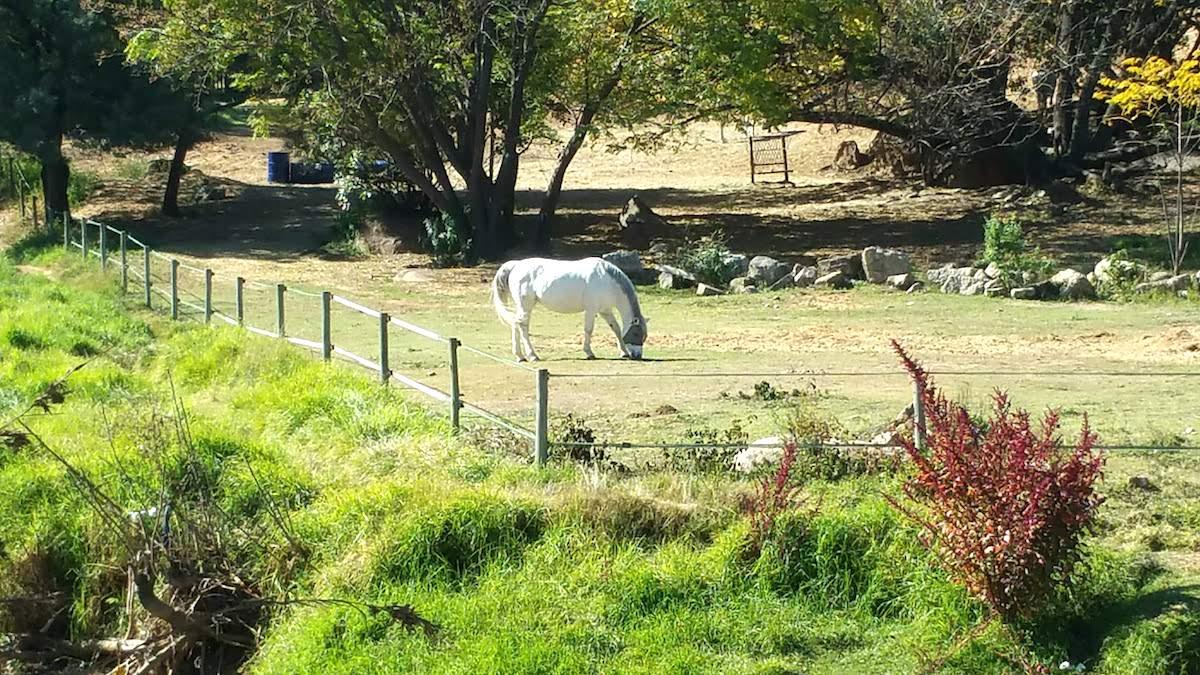
Lone horse at the Field and Study Centre (The Heritage Portal)
Early Joburgers relied more heavily on the river than we do these days. They fished in it, used it for their household needs, their cattle grazed alongside it and drank from it, children used it as a playground, and when it flooded, caused consternation to those north of it, who were cut off from services like doctors, schools and the postman.
The Braamfontein Spruit begins life in the grounds of the Barnato Park High School in Berea, and has two major tributaries: Westdene Dam and Albertville.
Barney Barnato's lake
Mining magnate Barney Barnato built a grand mansion in Berea in 1897 and created a lake in front of it large enough for boating, in the surrounding five-hectare estate, now the large block surrounded by Park Lane, Beatrice Lane, Barnato Street and Tudhope Avenue.
The lake was filled from the spring that is the source of the Braamfontein Spruit, and it was surrounded by landscaped gardens of conifers, some of which are still growing. One tree, a cork, still exists, its magnificent trunk rising up from the ground like a gnarled giant.
Barnato never lived in his mansion - some believe he was pushed overboard from a passenger liner on his way to England in 1897, while others think he committed suicide by jumping into the sea. All that remains of his estate are three magnificent wrought-iron entrance gates (the fourth was stolen), and the original gate house, in Barnato Street, now used as a shelter for abused teenagers.
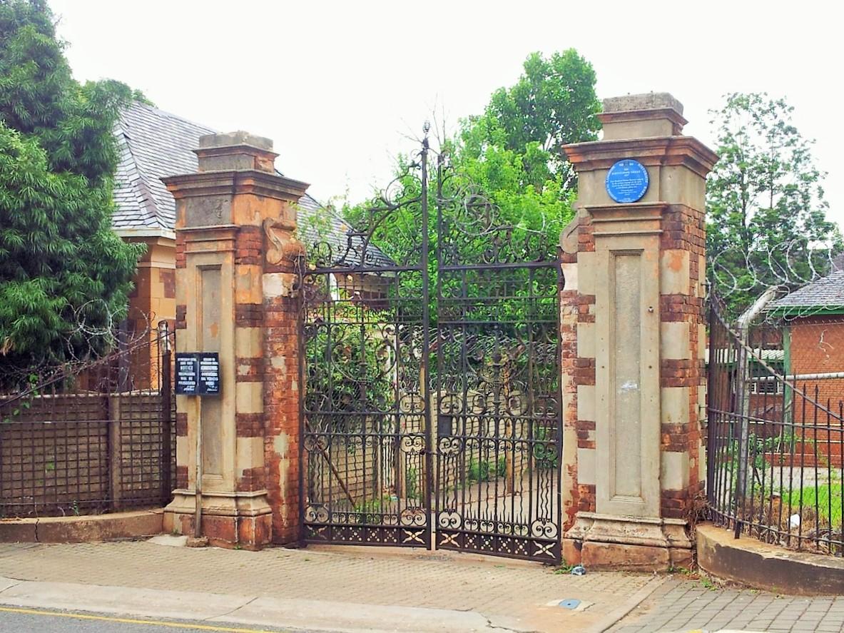
The famous gates (The Heritage Portal)
Barnato Park High principal, Agnes Nugent, believes a half-moon piece of tarmac in the middle of the school grounds is all that is left of the lake's edging. The school's swimming pool - built in 1924 and still in service today, although in need of repair - is situated in the area where the lake was originally constructed.
Barnato's nephew, Solly Joel, presented the mansion and the garden to the government in 1910, to commemorate South Africa becoming a union in that year, and a school, the Johannesburg High School for Girls, was built alongside the mansion in 1913. The mansion was used as a boarding house for girls until its demolition, together with the school (both had become fire and health hazards), in 1962. A new school - a co-ed, now catering for 1 000 pupils - was built in 1970.
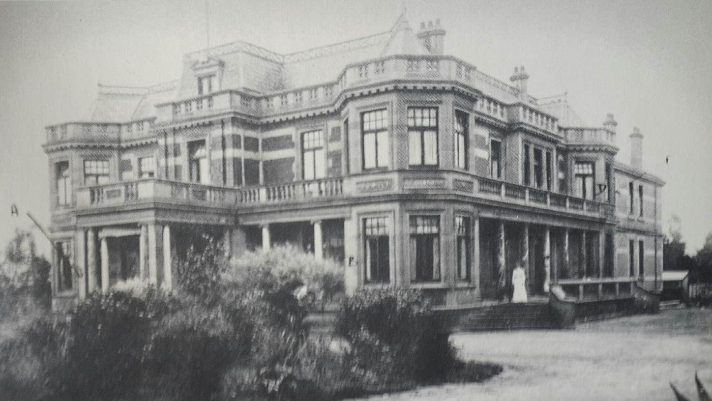
Joel House (Lost Johannesburg)
From Berea the stream runs through Pieter Roos Park, down Empire Road to the Frank Brown Park, then on towards the German School in Auckland Park. The stream then flows towards the Parkview Golf Course, where sections of it are canalised. It exits the golf course and runs through Parkhurst, where it meets the second small tributary of the Braamfontein Spruit, the Zoo Lake Spruit.
The Westdene spruit has its origins just above the peaceful Westdene Dam, once a brickfield, according to Bodman, and now popular with fishermen. It flows north east under the RAU sports grounds, and down through the western and central sections of Melville Koppies, onwards to the popular Emmarentia Dam, to meet the third stream, the Montgomery Spruit at Tana Road in Victory Park.
Westdene Dam (The Heritage Portal)
This spruit, which lies over the next ridge with two small branches – one in Albertville, another in Albert’s Farm, Albertskroon. These two streams converge at the bottom of Albert’s Farm in Montgomery Park, and from it flows towards Delta Park.
The three streams merge at the bottom of Rustenburg Road in Victory Park, heading towards Delta Park, then wend their way through the northern suburbs, heading towards its confluence with the Sandspruit at Sunninghill Park.
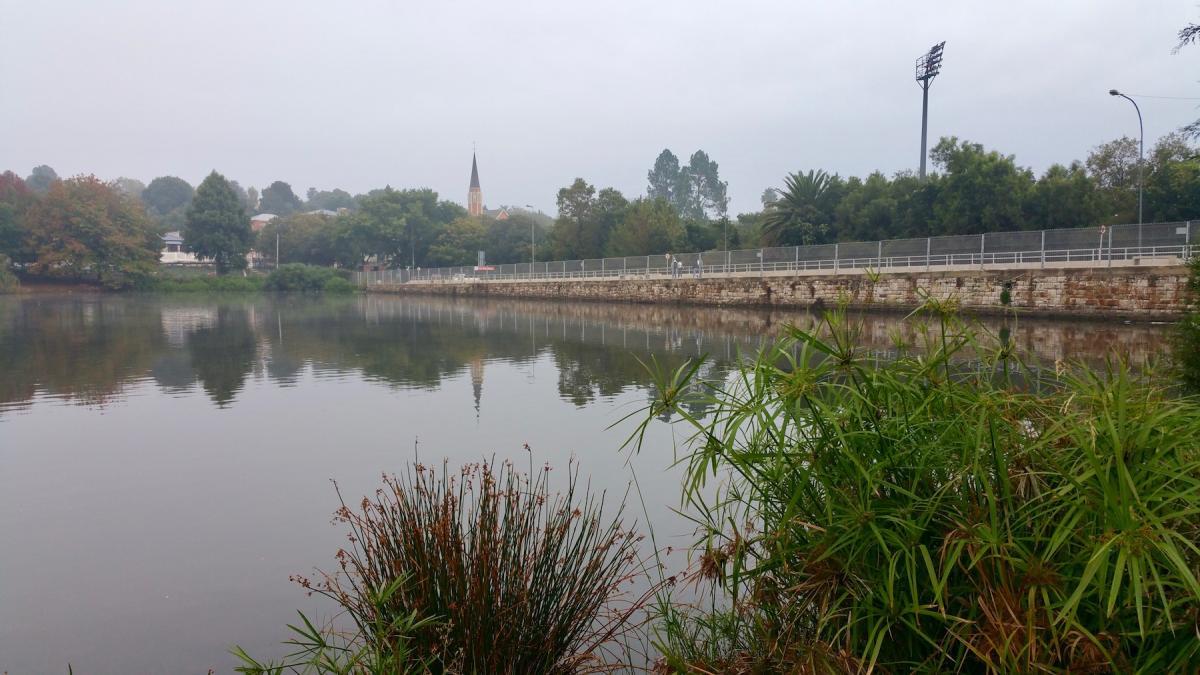
In decades past the Braamfontein Spruit was dammed in Craighall, forming what was known as Rattray's Dam. William Rattray bought the farm Klipfontein in 1891 and renamed it Craighall, nowadays the suburbs of Craighall, Craighall Park and Blairgowrie.
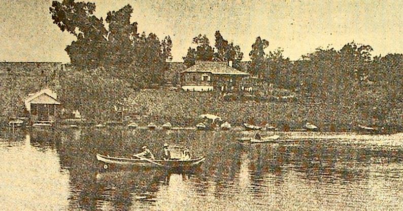
Craighall Lake (Like it Was)
Rattray's - a large lake held back by a 50m wide stone wall, until the dam become silted up in the 1930s - was the premier leisure resort for Joburgers. Today the beautiful stone wall still stands, and water cascades over a small central section. The dam is now filled with reeds and a row of weeping willows, with the water meandering around the island that has formed. The wall is visible from the bridge in Conrad Drive.
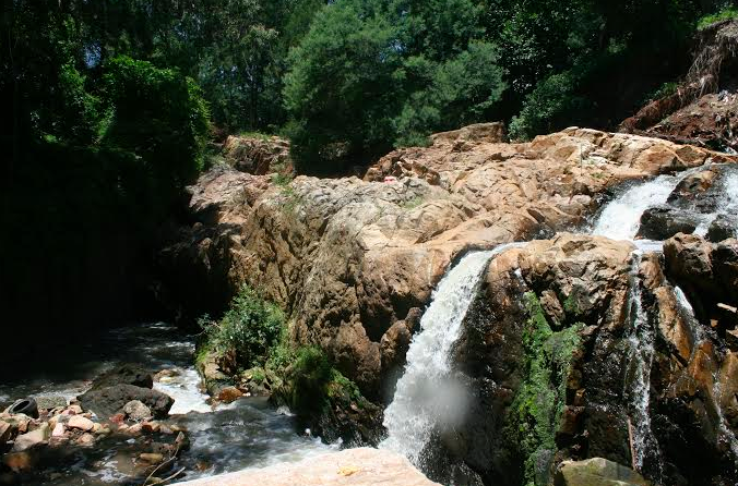
Rattray built another weir, about a kilometre further down the river, still intact, with water tumbling over the wall into a series of natural waterfalls. He apparently also built a third weir, which could be one of a series of walls a kilometre below the waterfalls.
Another natural waterfall exists on the far eastern edge of Melville Koppies, called the Waterfall Palace. It's a rocky two-level waterfall, dropping down three metres into a pool channelled down a tunnel through the Parkview Golf Course, just below the bridge over Rustenberg Road that links Parkview and Melville.
Waterfall Palace or Melpark Waterfall (William Gaul)
The waterfall is surrounded by sandy banks and trees and the two-acre area has a tranquil charm about it. Although now locked and inaccessible, it used to be another favourite picnic spot for early Joburgers.
Although no one fishes in the Braamfontein Spruit, according to long-time Joburg environmental writer, James Clarke, trout were seen at Lonehill as late as 1978, probably having swam upstream from the Magaliesberg, some 80km north west of the city.
Carp, yellow fish and koi (washed in from domestic fish ponds) have been spotted in the river, according to Paulette Malcolm, chairperson of the eco-mmunity for Ward 90. She is keen to establish fly fishing at the river, and with the introduction of lavendar and buddle along the banks, butterflies may return. She says that frogs and dragon flies are back, mainly the result of a cleaner river.
The Braamfontein and Sandspruit merge at Leeuwkop Prison, at a rocky spot marked by a large gum tree. The resultant river, of several metres across, is called the Jukskei and meets the Ellis Park Jukskei a kilometre or two beyond. Then it gains volume and width as it flows in the direction of Hartebeespoort Dam, north west of Johannesburg.
Klein Jukskei
Moving further west is another set of streams, which, once they converge, form the Klein Jukskei River. The source of the river is a small dam in the Willem Conradie Park in Florida Hills. Several small tributaries bolster this stream as it moves north towards Olivedale, but at the Veldskoen Drive-In it is joined by the Pampoen Spruit, which rises in Constantia Kloof, north west of Florida Hills.
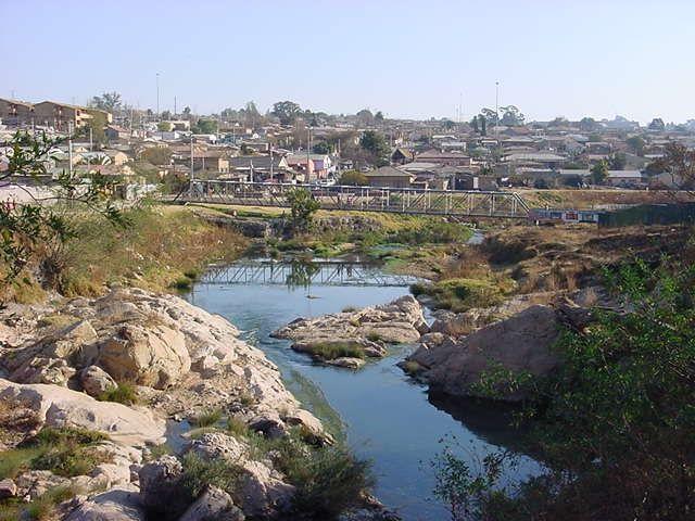
From the confluence of these streams, the river surges on as the Klein Jukskei River and meets the Jukskei at Chartwell, and flows north as the Jukskei, which then meets the Crocodile River 3-4 km north of Lanseria Airport, from which point it is referred to as the Crocodile, and flows into the Hartebeespoort Dam.
The Crocodile River rises in Roodepoort, from 5-6 springs above the Witpoortje Falls in the Walter Sisulu National Botanical Garden. It runs through Muldersdrift and out towards Lanseria where it meets the Jukskei.
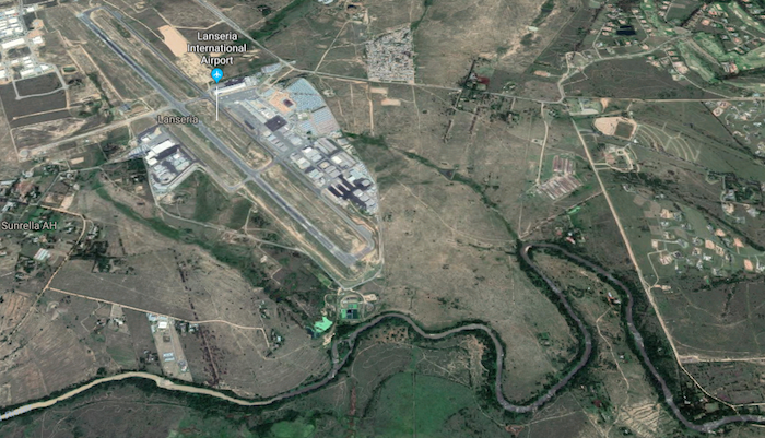
Jukskei River flowing past Lanseria Airport (Google Maps)
The Crocodile flows out of Hartebeespoort Dam and meets the Marico River, which runs along the border with Botswana. They merge with another tributary, the Lenkwane River, in Limpopo, and at this point, near Olifants Drift, according to Mike Silberbauer, senior specialist scientist at the Department of Water Affairs and Forestry, the Limpopo River begins.
It surges on, flowing north east, forming the border with Botswana and Zimbabwe, through the border posts of Pontdrif and Beit bridge and exiting South Africa just north of the Kruger Park gate, Pafuri, into Mozambique. Then it flows down through western Mozambique and reaches the Indian Ocean just below Xai Xai, about 200km north of Maputo, as a mighty river. It's a journey of about 1 800km, and at its mouth the river is about 800m wide.
Bodman, writing in 1981, bemoans the disrespect the City and its citizens have shown Joburg's environs, and concludes her booklet with the following sobering assessment: "In the interface between people and the environment, it is usually the environment that must change. People are learning, however, what is 'good' change and this must be encouraged. A new dimension has come into technological thinking, viz: the knowledge that old mistakes need not be perpetuated and can in fact often be corrected. Our rivers and our little mountains are a precious natural heritage to be conserved for the future."
Lucille Davie has for many years written about Jozi people and places, as well as the city's history and heritage. Take a look at lucilledavie.co.za