Disclaimer: Any views expressed by individuals and organisations are their own and do not in any way represent the views of The Heritage Portal. If you find any mistakes or historical inaccuracies, please contact the editor.
Mpumalanga Heritage is running a massive project to replace old plaques and install new ones along the wagon routes that stretched across the Lowveld to Delagoa Bay (click here to read a recent article in the Barberton Times). Many South Africans are familiar with these routes as they were made famous by Sir Percy FitzPatrick's classic novel Jock of the Bushveld. The current project appears to be the third major effort to mark these routes. The first was established in 1950 and the second followed in the 1980s and 1990s. The article below was compiled by Brian Simmons who was one of the key personalities behind the second effort. His passion verging on obsession shoud provide ample inspiration for the current generation of researchers. The article appeared in the Johannesburg Historical Foundation's journal Between the Chains in 1996/7.
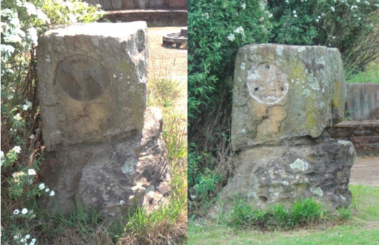
Many of the old plaques have been stolen (Mpumalanga Heritage)
I first became conscious of Jock of the Bushveld when I was about five years old growing up in the village of Sabie. My father used to treat me to after-dinner readings of the famous book sitting in his favourite armchair with me on his knee. He was usually able to answer my questions concerning Jock's exploits, but when these referred to specific places he was at a loss! Where were the remains of the old Transport Road? Where were the Sandstone Sentinels and Paradise Camp? Where was the Sheltering Rock which protected FitzPatrick from the obliterating hailstorm?
My dad simply did not know the answers and neither did any of his knowledgeable friends in Sabie, Macmac, Graskop or Pilgrim's Rest. It seemed amazing to me then, and still does even now, that my father, who had arrived in Sabie in 1908 only 16 years after the last transport wagon had left Lourenco Marques for the Lydenburg Goldfields (as Spitzkop, Macmac and Pilgrim's Rest were known in 1891/92), had no idea of the route taken by the old road.
It was not until I was sixty years old that I discovered that I had crossed it twice a day as a boy, walking to and from my first school - the Sabie Primary. In later years after becoming a farmer at Karino I still wanted answers to my childhood questions on the subject. Locating Paradise Camp in particular became something of an obsession but no amount of reading and re-reading the relevant chapter in Jock of the Bushveld brought the seemingly mythical site into focus.
From about 1960 onwards I usually managed to persuade my wife and family to have at least one annual picnic in the vicinity of Graskop where I imagined the camp to have been situated. While my family always seemed to enjoy the outing, the solution to my search remained an enigma. However, not all of our efforts were in vain. My two younger children and I found FitzPatrick's Sheltering Rock on the western slope of Stanley Bush Kop after the second attempt. Then we found the drift where he rescued the transport rider threatened by the flood, described at the end of the book's first chapter, at the first try. These minor successes encouraged me to continue searching for Paradise Camp and the Sentinels, both of which proved to be tough nuts to crack.
The subject of the entire route of the old Transport Road and the later links to it cropped up specifically for me during 1982. My family and a friend Derick Coetzee were invited to a Sunday lunch at the home of Mr and Mrs Vingoe Hodge of Mistlands, above Low's Creek. After the meal we were shown the swales (rutted remains) of the two old roads on the adjoining farm Waaiheuvel, leading into Northern Swaziland. Mr Hodge mentioned that one of the roads was named after the pioneer digger and prospector French Bob (Auguste Robert) who dated from the earlier Macmac and Pilgrim's Rest diggings. When we were ready to leave the scene I asked my friend Derick, who had an excellent knowledge of Lowveld history, whether he knew where the old transport or so-called Jock of the Bushveld roads were located. Responding to his negative reply I suggested that we should team up to find out. He agreed there and then and we shook hands on a future pleasant and fruitful partnership which I was later to name Coetzee and Simmons.
The partnership of Coetzee and Simmons
Having been employed as an extension officer in the Department of Agriculture for most of his working life, Derick had an intimate knowledge of much that was to prove useful in our search. For example, he was able to order required strips of aerial photographs taken in 1936 and 1944 for a South African Mapping Survey by the South African Air Force. These surveys were amongst the first undertaken anywhere in the world. We only required to estimate the approximate route of the old road to have it confirmed by the aerial photographs. In this way we were able to 'read' the route of the old Transport Road all the way from the Mozambique border to just short of Lydenburg.
Unfortunately the old road did not show up clearly in the aerial photographs over sandveld areas such as the Kruger National Park. We realised that we would not be able to trace it through the park anyway, since permission to get out of a vehicle could not be obtained. Consequently we approached the warden of the park through the auspices of The Lowveld Diggers' and Transport Riders' Society, for assistance with the project. Dr U de V Pienaar was kind enough to appoint Mr Thys Mostert, senior ranger at Pretorius Kop, to establish the route between Nellmapius Drift on the Crocodile River and Numbi Gate. This he accomplished successfully.
Armed with the relevant aerial photographs Derick and I commenced our Odyssey from the Mozambique border at Matibiskom, approximately 25km south of Komatipoort in 1983. On the first day we were accompanied by a Komatipoort friend of Derick's who was familiar with the border area. This friend had no difficulty in locating the swale of the old Transport Road where it crossed the then unfenced border of the lowly Lebombo range. It was perhaps fortunate for us that we did not meet up with an AK 47 wielding Frelimo soldier as Mozambique was regarded as enemy territory at the time. The possible threat did not deter us from having a good look in the direction we estimated the old road would have taken from Mozambique and thinking about the old outspan places on route. These included Progresso de Guedes, Tom Barnett's Store (where Jock lost his life and was buried under a wild fig tree alongside the hostile Field-Cornet Seedling), and Compos Corvo where Nellmapius's partner Alberta Rapoza was murdered by a Sotho gang in 1876. The route of the old road into Mozambique was not clearly visible from our elevated position, possibly because of the pebbly ground there. However, it was clearly imprinted on the Mpumalanga side in a north-north-westerly direction over the farms Avondston and Castilopolis. Unfortunately, the swale was no longer distinct over the cultivated lands of the adjacent farm Coopersdal.
Derick Coetzee was on familiar ground on Coopersdal having managed the property for its Bonuskor owners for several years prior to his retirement. He was authoratively able to show the line of the old pont crossing on the Komati River. He was also able to pinpoint the exact spot where he had directed the excavation of Julius Furley's original pont from its sandy grave close to the river's east bank. Apparently Furley simply abandoned his trading store and pont when the Eastern Railway line, under construction between Lorenco Marques and Pretoria, reached Komatipoort in 1891. Since no Lowveld authority was interested in providing a home for the pont it was offered to the James Hall Transport Museum at Wemmer Pan, Johannesburg. A transporter with a flat-bed trailer was dispatched to haul it to the museum's premises. Once there the pont was expertly restored to its former glory, becoming one of the outstanding exhibits in the fascinating array of South African transport relics exhibited by that truly excellent museum.
We found a good deal of difficulty in tracing the precise route of the old road between the Komati River and Nellmapius Drift on the Crocodile River because of the awkward access onto fenced property along the way. However, we were easily able to define where its path crossed the Eastern Railway line on the western side of Oorsprong siding. From there it was only a short distance to Nellmapius Drift where FitzPatrick, Jim and Jock had their fight with the old crocodile, as described in Jock of the Bushveld.
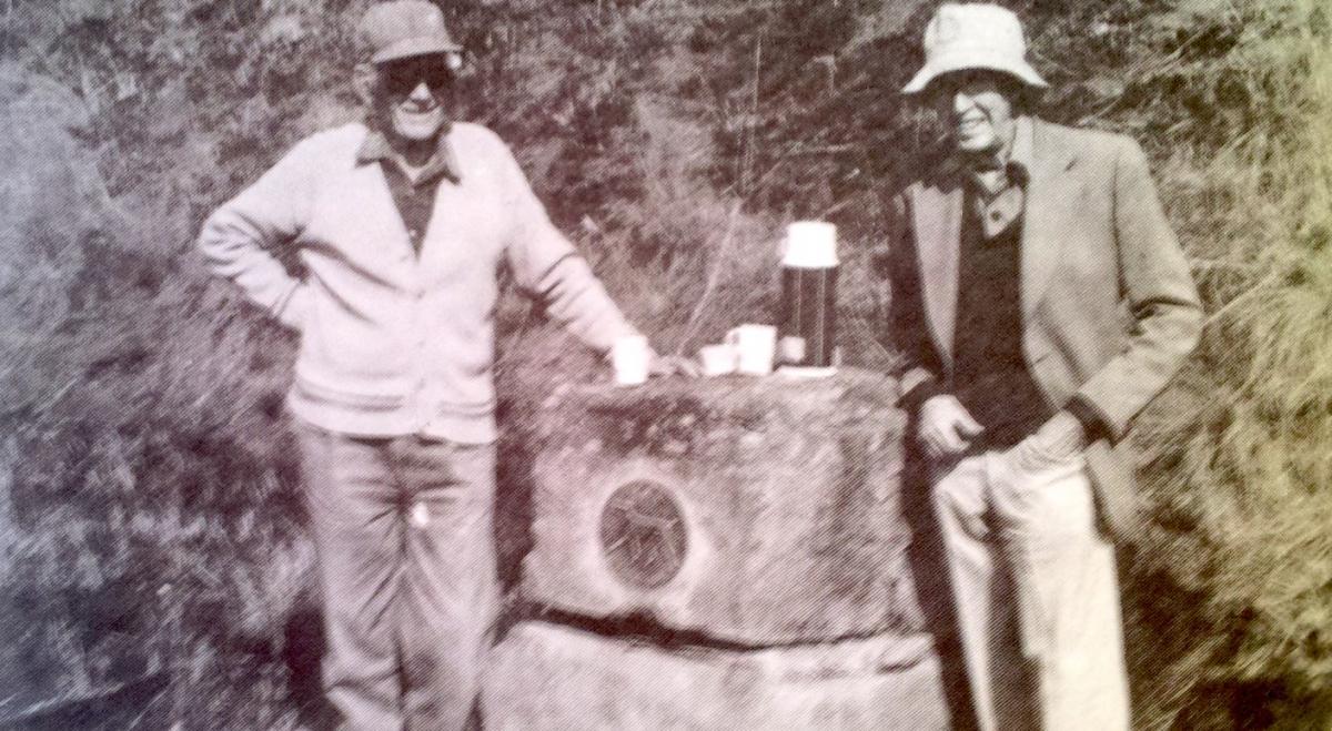
For the reason previously mentioned, Derick and I skipped the Kruger National Park to resume our rediscovery of the old route west of Pretorius Kop's Numbi Gate. Visitors to the park entering and leaving through this gateway will surely recollect the impressive Jock of the Bushveld cairn standing just outside the gate. This cairn and its bronze plaque is one of the originals erected by the Transvaal Provincial Administration in 1951. The concept of marking the route of the old Transport Road was initiated by Mrs Cecily Niven, Sir Percy FitzPatrick's daughter. She presented the required bronze plaques for fitting into appropriately placed rock cairns along the route. The concept was accepted and put into practice by the Transvaal Provincial Administration thanks to the efforts of Mrs 'Tant Sus' Davel of Machadadorp, a member of the Provincial Council for then Barberton constituency.
The swales of the old road are occasionally visible along the watershed route between Numbi Gate and the present road junction with the White River-Jerusalem-Hazyview main road, north-east of M'timba Kop. The watershed mentioned divides the catchments of the N'sigase and Phabeni streams. Water from the Phabeni was used by pioneer Joao Albasini in 1846 to establish the first known irrigation project in the Lowveld. This was at his Magashula's Kraal Trading Station close to where the Phabeni enters the Sabie River.
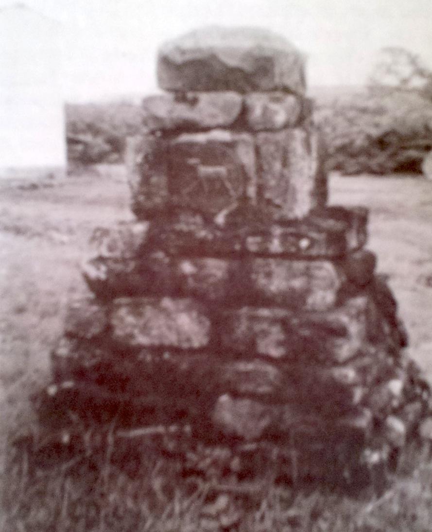
Instead of maintaining its generally north-east heading onto the adjacent farm, Burgershall, the old road then swung south-west. It ran close to the previously mentioned present-day road junction to cross the southern shoulder of M'timba Kop, before descending to cross the North Sand River. Continuing in the same general direction it rose on the farm Peebles to breast the substantial divide separating the catchments of the North Sand River and White River, past pioneer Bill Sanderson's home. Another monumental cairn was erected by the Transvaal Provincial Administration alongside the road in front of Sanderson's old home to confirm the route at this point.
One of the old Cairns
The old road then crossed the White River through the existing Klipkopje Dam to rise again up the westerly slope past brother Bob Sanderson's former home and the distinctive outcrop of rocks which provide the name for the farm Klipkopje. Soon after passing the rocks the road bends in a generally west-north-westerly direction along another extensive watershed separating the catchments of the White and yet another Sand River flowing towards Nelspruit. This ridge route extends for approximately 10km over the farms Klipkopje Swartfontein and Kruisfontein. Running along this ridge the old road was fortuitously able to negotiate a difficult obstacle known as The Dongas. This is identifiable for the present-day traveller by an extensive curve in the modern White River-Sabie main road under the massive Eskom powerlines heading north to Phalaborwa. The road then ascended the abrupt edge of the berg over Kruisfontein onto the farm Lekkerlach. From there it proceeded in a long descending line over the farms Leith, Ophir, Elandsdrift, Spitzkop and Grootfontein to pass over what later became Sabie's market square. The third 1951 Transvaal Provincial cairn was situated alongside the road on the farm Spitzkop. This was a simplified cairn consisting of only two large rocks standing one on top of the other with the usual bronze plaque inserted into the upper.
Heading generally northwards from Sabie's market square the old road crossed the Sabie River at a drift approximately 200 metres above the Sabie Falls. It continued through the farms Waterval, Tweefontein and Geelhoutboom where yet another 1951 rock cairn was placed. The road then swung generally north-west to cross a low point in the extended Drakensburg or Kahlamba range over Burgers' Pass. Descending to the Blyde River it crossed through a difficult drift before swinging northwards again down the valley of the Blyde. The wagons then had to negotiate another six drifts before entering the mining village of Pilgrim's Rest up a steep incline - no longer in use - at its north-western extremity.
While Pilgrim's Rest was regarded as the main point of sale by most of the transport riders, the true terminus of the old Transport Road was the mother town of Lydenburg. For those wagons continuing beyond Pilgrim's Rest their first westward obstacle was the formidable Pilgrim's Hill, now known as Robbers Pass. The grades on portions of this hill were a little worse even than those encountered on the Burgers' and Kruisfontein passes. The fifth 1951 bronze plaque marking the route was inserted into a massive rock close to where the old road finally reached the top of the hill. The route then continued generally westwards over the plateau before descending into the upper Ohrigstad valley over the farm Doornhoek. It then negotiated two drifts on Rietvallei and Rosenkrans before turning south on the farm Klipheuvel where it joined the older Lydenburg-Ohrigstad wagon and coach road.
Heading generally southwards the wagons had to cross a ridge which later became known as Verraiersnek before declining into the Krugerspost valley where Jock had his epic fight with Seedling's baboon. Further south the road crossed the Spekboom river and soon after, the Potloodspruit, before entering Lydenburg where it terminated in the market square. The last of the 1951 cairns was incorrectly erected on the east side of the Steenkamp's bridge over the Spekboom, which had not been constructed in 1885. The old road had gone directly through the river.
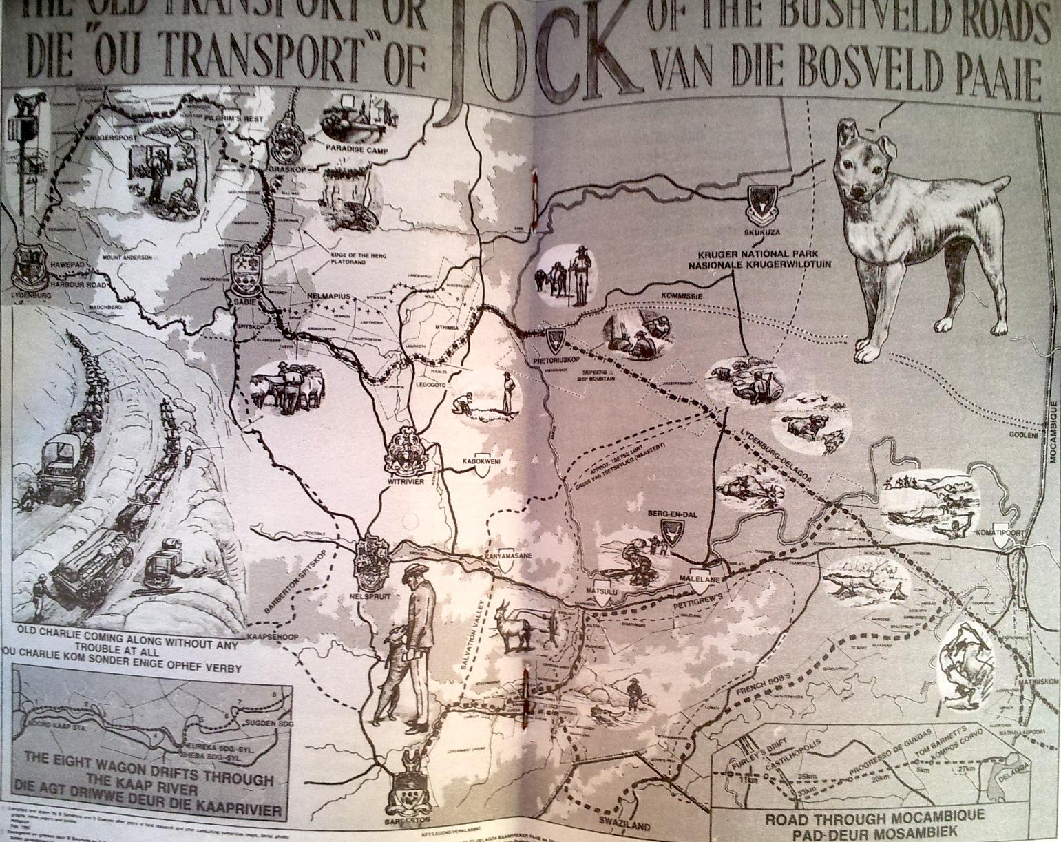
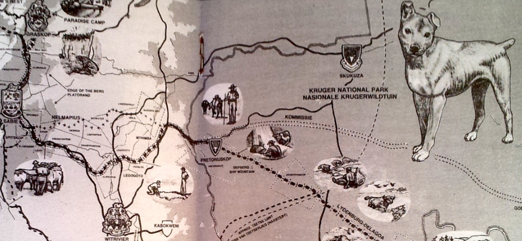
Derick and I were pleased to complete our odyssey in Lydenburg's market square late in 1994. We clearly realised, however, that our self-imposed pro bona publica effort on which we had already journeyed for many thousand kilometres had only just begun. We considered that at the very least an accurate, illustrated map of the old road showing where it crossed the modern tarred provincial roads was necessary. Secondly we required to organise the selection of suitable rocks and insertion of the standard bronze plaques for siting additional waymarks on behalf of The Lowveld Diggers' and Transport Riders' Society. Thirdly we wanted to rediscover such elusive cultural sites as the 'lost' Paradise Camp and the Sandstone Sentinels and any others relating to the period 1873-92. Fourthly we considered that it would be necessary in the longer term to bring out some sort of tourist guide based on the Jock Waymarks. This would serve the interests of local, South African and foreign tourists who might wish to do some sort of pilgrimage along part or most of the old Transport Road.
The 'Old Transport' or Jock of the Bushveld Roads
Comments will load below. If for any reason none appear click here for some troubleshooting tips. If you would like to post a comment and need instructions click here.

