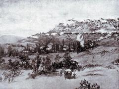
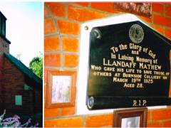
Although suffering from the worst drought in decades, one hopes that the rainy season is going to hit Zululand with a vengeance this year. From mid October onwards the heavens open up and the countryside transforms itself from harsh, barren, rock strewn tawny hillsides into rolling slopes covered with emerald green grass, rushing rivers and sparkling air. Looming massively on the skyline, and lit most afternoons by truly spectacular forked lightning streaking across the pitch black sky, Itala Mountain has a particularly eerie feel to it. Just like its cousin 30 miles to the west: Isandlwana.
Situated next to the Mhlatuze River, which, in 1901, formed the boundary between Natal and the Boer Republic of the Transvaal, it commands the road leading from Nqutu to Babanango, and the winding track heading off southwards toward Nkandla. On a clear day, one can see almost a hundred miles in most directions from the summit.
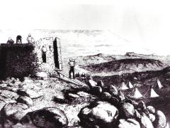
It has always been a strategic spot in the various altercations that have taken place across the centuries here. My interest in the site was originally sparked by a visit with Fred Duke and Neville Worthington many years ago. Then a few months later I came across an old group photograph entitled “The Officers and NCO’s of “G” Squadron, Natal Carbineers, Mooi River Camp. 31 August 1924”.
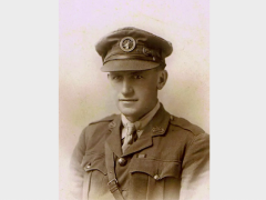
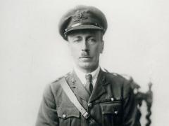
The soldiers in the photograph still stare self importantly back at you, even after 80 years. What sparked my interest was that a local farmer from Vant’s Drift, Major Harry Walker...