The Johannesburg Heritage Foundation has a fine large historic atlas for sale. It is being sold to raise funds for JHF. Yours for R1000. Email mail@joburgheritage.org.za. This is a special South African atlas and was the great work of the forties and fifties by Professor Talbot of the University of Cape Town .
Title: Atlas of the Union of South Africa. Talbot, A.M. and W.J. Published by Published by The Government Printer, Pretoria (1960)
Item Description: Published by The Government Printer, Pretoria, 1960. , ixiv 1-178 pages, vignettes to title pages, frontispiece is printed tracing paper overlay maps, contents includes maps and graphs, covers Relief, Geology, Mining, Soils, Vegetation, Fisheries, Climate, Water Resources, Population, Agriculture, Industry, Occupations, Transportation and External Trade, text in English and Afrikaans, corrections label on front paste down. First thus, the covers are still boards and the volume is in good condition, bound in green cloth with gilt titles to the front and spine, screw binding 44 x 57cm Hardback
The volume may be inspected at the JHF office. Contact Mrs Eira Bond - mail@joburgheritage.co.za | Northwards 21 Rockridge Road Parktown. Note this volume is too large to post and would need to be collected from the JHF .
Maps open your mind to the geographer and cartographer's view of the world . Here is an opportunity to acquire a slice of South African history and a great work of South African cartography. But so often a prophet is not recognized in his own country!
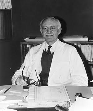
This great South African atlas was compiled by Professor William John Talbot of the University of Cape Town. His dates 1908 to 1985. Talbot hailed from the Isle of Wight and was an immigrant to South Africa in the 1930s. This atlas was his magnum opus.
Professor Talbot
Talbot was an exceptionally talented geographer and 20th century cartographer, he is described in the UCT web pages as "the man who made an atlas ". Today his vast map collection is a treasure of the UCT archive and is digitized, yet all Talbot's maps were made in a pre computer age. Talbot was a member of the Committee for Economics, Commerce and Geography, a component of the National Council for Social Research between 1946 and 1972. The atlas was compiled to provide the data to support plans to address issues of economic development in South Africa. Of course it was the apartheid era but even within those constraints development was not possible without a knowledge of existing resources and social structures. This great Atlas is fascinating because it contains some 600 hand drawn maps, plus accompanying graphs and diagrams and is a magnificent work produced almost in a political void.
Talbot produced this huge magnum opus with the support of a small department at UCT. He himself said of the enterprise "it is doubtful if any comparable national atlas in the history of cartography has been produced on so small a budget and such a 'do-it-yourself' basis". The atlas was first launched at an International Geographical congress in Stockholm in 1960 the 50th anniversary of Union. The cover is a dark green cloth, looking rather like a Springbok rugby jersey, resplendent with gold lettering. This atlas was 13 years in the making and involved thousands of hours of research and cartographic skills of Talbot and his wife Anna-Maria. In recognition of his work UCT awarded Talbot a fellowship. It has been described as a fine example of South African cartography.
(information sourced from Geographers : Bibliographical Studies vol 32 , 2013 , see Michael E Meadows, edited by Hayden Lorimer , p 131)
Very few copies turn up and when they do, it is more likely that you will find them in antiquarian bookshops abroad. It is a volume more appreciated overseas than in South Africa. Here is one such antiquarian description.
Normally selling on the Internet at $120. The JHF price is R1000.
Disclaimer: Any views expressed by individuals and organisations are their own and do not in any way represent the views of The Heritage Portal.

