Review of Barberton Makhonjwa Geotrail - Geosites and Viewpoints. First question – what is a geotrail? Let this book introduce you to the concept and the place. A geotrail is a route that takes us on a journey through remote time and space to geologically important sites and viewpoints (in this case in the Makhonjwa mountains). This is time travel at its best. Geology becomes the tool and the source of organized knowledge to find evidence of the earliest life forms on earth - a band of single cell organisms visible to the naked eye. This unique place reveals what happened on earth 3.4 billion years ago. This should inspire you to race to Barberton and the Makhonjwa mountains. You have to place this magical area on your “bucket list”. How fortunate we are that this tourism drawcard is so close to the Kruger National Park, another world beating heritage place. Not to mention that this is mining history country.
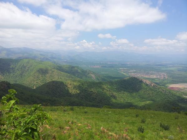
Glorious Barberton Mountain Land (The Heritage Portal)
This is a book review with a difference. How often does one discover a place and an excellent guide book at the same time. I recently visited Barberton to attend the Heritage Association of South Africa’s annual symposium. The Barberton Makhonjwa Geotrail was the bonus, it was the Saturday morning excursion. More than sixty of us departed from the Barberton Museum in several motor cars and three luxury mini buses provided by Terry’s and Simeliza Tours. At the end of the tour I bought this book but I should have had it in hand as we travelled. No matter, owning the Ferrar and Heubeck Geotrail book means that I am now well equipped to return for a second visit.
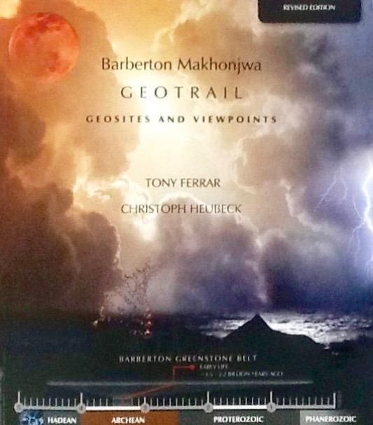
Book Cover
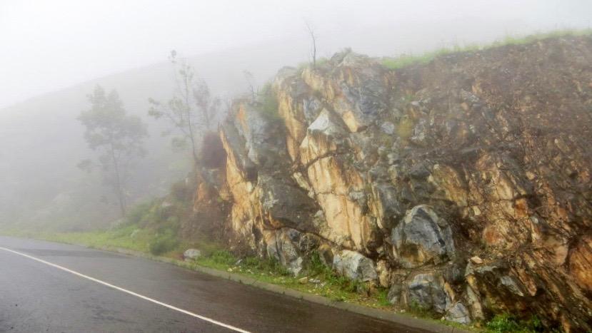
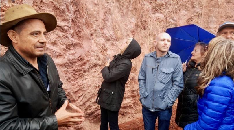
The day started as a gloriously warm Lowveld spring morning but conditions rapidly deteriorated. Temperatures plummeted, it began to drizzle and a swirling mist hid the panoramic views. Thankfully, the anticipation of an adventure kept our spirits high. It isn't often that one has the author of the authoritative guide book leading a tour. The geologists called the weather “foul“ but they are tough mining types and the tour went ahead. We were there to see, listen and learn and forget bodily discomforts.
Rock formations in the mist (Kathy Munro)
Tony Ferrar and geologists Dion Brandt, Chris Rippon and Morris Viljoen were our guides for the morning. This review is an account of both a book and a memorable experience. Next time, I shall choose perfect weather and make it a two person adventure. If lucky I will appeal to Tony, Dion, Chris or Morris to do it all again. They are the professionals!
In fact, I concluded that the Geotrail with accompanying guidebook should be planned as a full day excursion. It is one of those South African tourist sites that is a must see that has been opened up by people with passion, determination and knowledge.
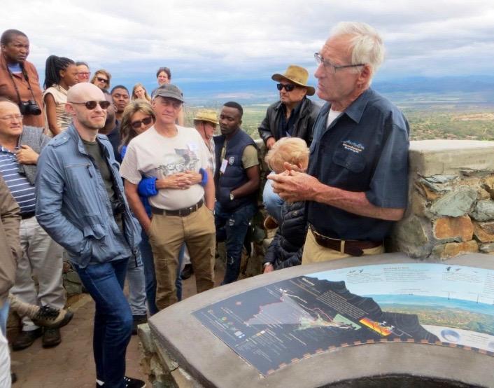
HASA delegates enthralled by Tony Ferrar (Kathy Munro)
Sometimes South Africa surprises, excites and delights with a project or a place that takes the world stage. There is that “Wow, I am proud to be a South African“ moment when you learn that the area has been proclaimed the newest UNESCO World Heritage Site. Daily we read about the economic plight of the country and see our business rankings slipping but here is a unique and very beautiful place that compares favourably with the very best in the world. I can say that with confidence too, as my husband and I have travelled widely in search of just this type of adventure tourism. This is a good news story.
The excellent and accessible guidebook combines a tour of the Geotrail and Geology 101 in a well- illustrated, large format 40 page book. It brings together evocative photographs, clear maps, timelines and easily read diagrams to explain and pack the punches with dense but accessible information. A revised edition has just been published to coincide with the achievement of UNESCO world heritage status.
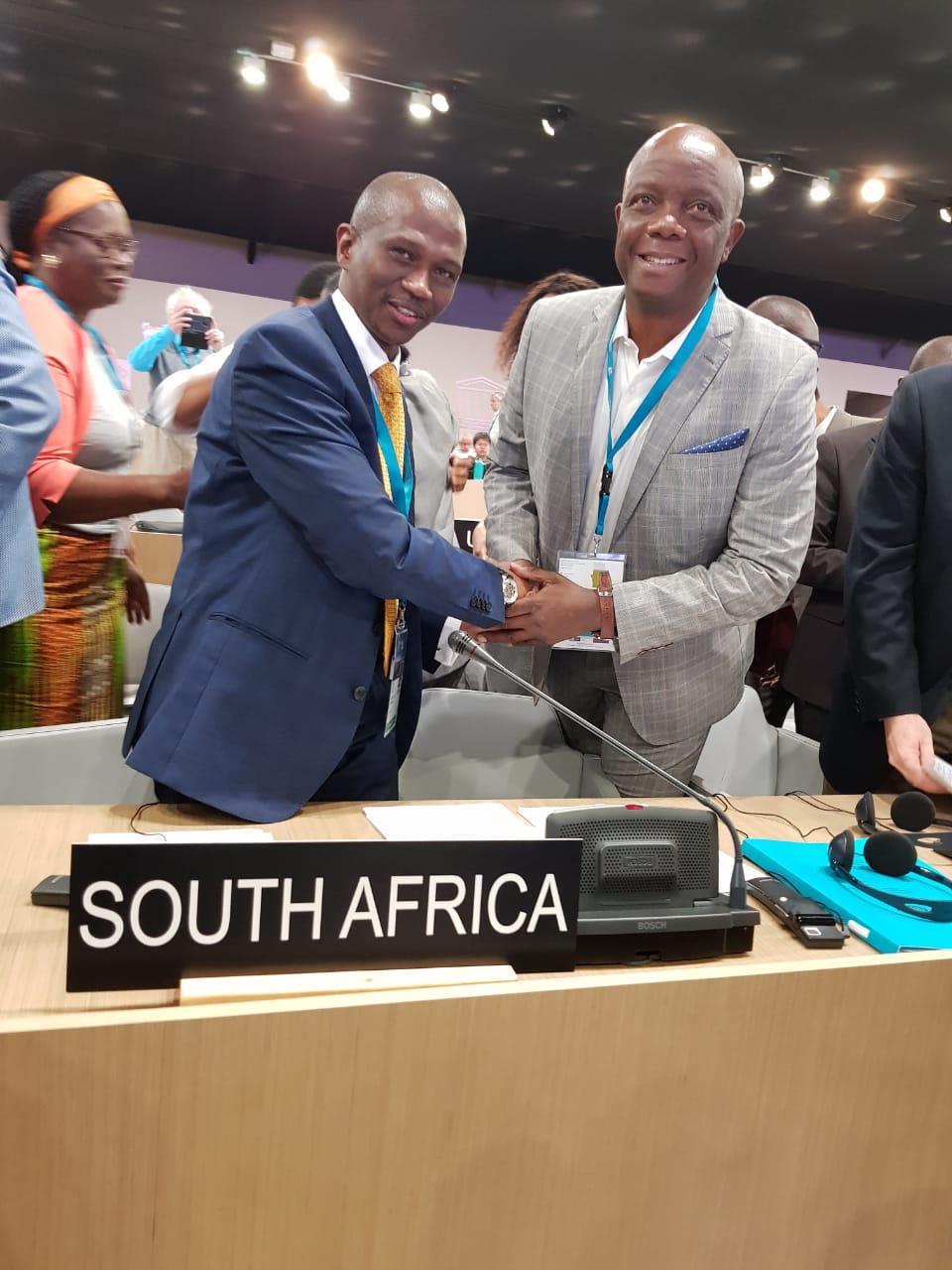
For over ten years, Tony Ferrar has campaigned for the Barberton Greenstone Belt to be recognized as a World Heritage Site. In March 2008 “the Barberton-Makhonjwa Mountain Land” made it onto the UNESCO World Heritage Site tentative list. A team drawn from the Barberton Chamber of Commerce and the Barberton Tourism and Biodiversity Corridor (BATOBIC) and supported by Government worked with vigour, dedication and conviction to move the project from tentative to full recognition. In July 2018 Barberton’s unique Geotrail and the Barberton Makhonjwa or Greenstone Belt made headlines around the world when full World Heritage Site status was achieved.
National Heritage Council CEO Advocate Sonwabile Mancotywa congratulates MEC Sikhumbuzo Kholwane after the big announcement (National Heritage Council)
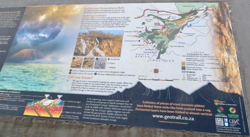
Before Pangaea this area became the first landmass rising from a scalding hot sea that covered the entire earth surface. Fortunately in the same way as one has carbon dating of fossil remains, the geologists have been able to create a timeline with the analysis of zircon’s progress through the eons to lead. This enables the accurate determination of the age of the rocks of the Greenstone Belt. UNESCO recognized that: “The Barberton Makhonjwa Mountains represents the best-preserved succession of volcanic and sedimentary rock dating back 3.6 to 3.25 billion years, when the first continents were starting to form on the primitive Earth. It features meteor-impact fallback breccias resulting from the impact of meteorites formed just after the Great Bombardment (4.6 to 3.8 billion years ago), which are particularly well preserved.”
A detailed nomination report (2017) prepared for the UNESCO submission can be found online. It’s a great achievement and a model for other heritage bodies in South Africa. We learnt with great regret that four other South African sites and places have been dropped from the tentative UNESCO list. South Africa should have half a dozen more World Heritage Sites (we currently have ten with another five remaining on the tentative list).
The whole area is accessible because of the well-engineered macadamised road. The road winds on an excellent unused tarred road to the Swazi border post at Josefsdal / Bulembu Border Gate. The Geotrail is on the 38 km route along the R40 that connects Barberton to the border. There is a bit of personal history to drop in here as my husband’s grandfather, James Walker Munro, was involved in drawing up the Swaziland boundaries and had the misfortune to be hit on the head by a Swazi chief - so our family oral history goes. I wonder if he was ever here. The road was originally created for the Havelock (now called Bulembu) asbestos mine located in Swaziland, close to the border. The tar runs out at the border. The mine is now closed but Bulembu has become a village for Swaziland orphans and has an excellent museum. There is a touch of serendipity in the story as the road was made because of the mining activity but in the process of road construction the rocks were exposed and a far more ancient geological story unfolded. It is a road that takes you on a journey to the origins of the earth by reading the rocks and geological formations. Barberton leads the way with this initiative and the challenge of preserving the rocks. It was fitting that the HASA annual conference should be held in the town in October 2018 and that the Geotrail was the big news. At the gala dinner HASA recognized the work and achievements of Tony Ferrar with the presentation of the Association’s Gold Medal.
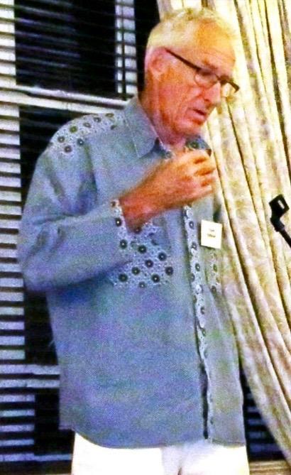
Tony Ferrar accepting his award at the HASA dinner (Kathy Munro)
In his acceptance speech, Ferrar touched on how difficult it was to explain the purpose of the Geotrail. This is because a Geological route and area is not easily recognized as a cultural heritage site, it is not a scenic natural wonder and geology may not hold everyone in thrall. But geology and discovering the rocks that teach us about the planet’s origins has to have world recognition. This is the genesis of life. If you have puzzled about human origins and know that the Cradle of Humankind at Sterkfontein reveals that man started the human journey in Africa then this geological landscape is a much earlier part of knowledge that grapples with the origins of life and tells how the earth was formed. I learnt that whilst I as a heritage enthusiast might see a rock as a rock or a potential building material, a geologist views a rock as an artefact that reveals early secrets about the earth and every rock tells a different tale.
The Barberton Greenstone Belt in the Makhonjwa Mountain range is a scientific laboratory and this book is a lively textbook to educate us as we make the journey by car. There are eleven view sites or stopping points en route. This book documents and explains the grains of life to be found in the rocks. The language of geology - conglomerates, synclines, sedimentary, volcanic, biomats, meteors, baryte - is given meaning through looking at the rocks with this book in hand.
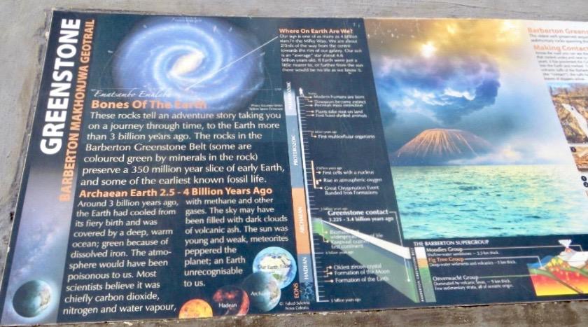
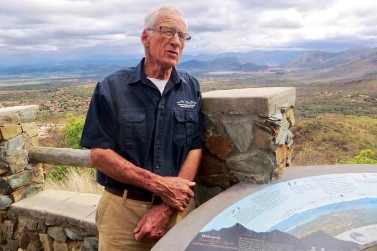
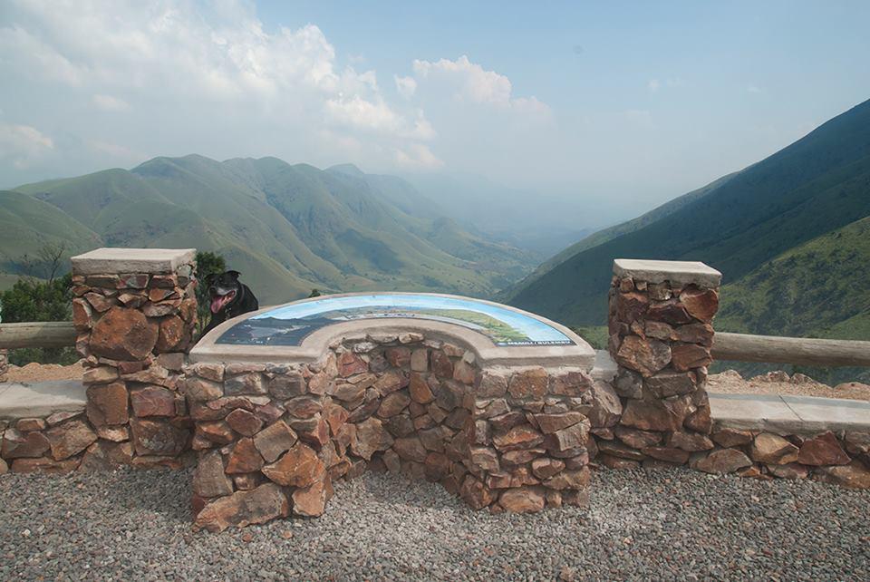
An information board on the Geotrail (Kathy Munro)
The Geotrail guide book provides all the information required for the layperson about Tidal Sandstones, Alluvial Conglomerates, Biomats, Dycedale Syncline, The Painted Quarry, Byrite Boulders, Tsunami Conglomerates, Banded Ironstone, Volcanic Lapilli, Black Chert and Pillow Lavas. The photographs draw you into the landscape and what it all means. It is a unique place not only because of the age of the rocks, but also because of their fine state of preservation. Here are some of the oldest rock formations when the surface of the earth was cooling down, showing how stable land masses gradually emerged from oceans in which only scattered volcanic peaks aligned as island arcs had existed before.
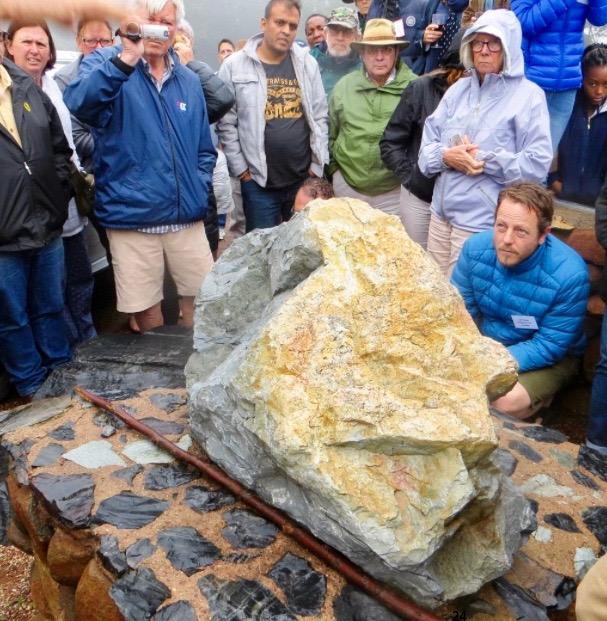
Dion Brandt, educating the HASA group on how to read the 3.6 billion year old rock formation (Marjorie Nuns)
This is the area of the Greenstone Belt and suddenly you are plunged into the scientific language of the geologists - hadean, archaean, Proterozoic and Phanerozoic. It is the Archean period that is central to what this is all about. Here is the treasure house of the planet’s remote and deep history. I had previously thought of Barberton as a fascinating place of early gold mining adventure but it’s the ancient geology that that has far greater scientific significance.
The meaning of the word Makhonjwa is difficult and complex. It is an iSiswati word that seems to capture the sense of being the mountains one should not point at – there is a sense of mystery and hidden knowledge; it’s a mountain that keeps its secrets. Now the scientists are revealing some of those secrets and the mountain calls to draw the experts to apply their knowledge and keep searching for answers. The landscape is hauntingly beautiful. This is Jock of the Bushveld country. It is also an area rich in mining potential as has been recognized for more than 140 years.
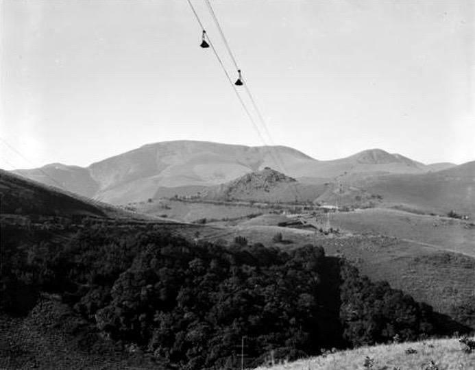
There is an interesting cableway running from Havelock to Barberton. It runs overhead for 20.36kms (a fraction of the road distance). The cableway was constructed by a German Company Bleichert (a famous German engineering firm founded in 1874 by Adolf Bleichert). The cableway was constructed between 1936 and 1939. It carried cocopans filled with asbestos to the railway station of Barberton. These were then sent on the return journey back to Havelock filled with coal for the mine’s power station. Each cocopan carried a load of 200kgs and moved at a speed of 11kms an hour. It was reputed to have been one of the longest cableways in the world and was a remarkable engineering feat.
1954 photograph of the Havelock cableway (SAR Publicity and Travel Department via DRISA)
The Havelock mine belonging to Turner & Newall was one of the largest asbestos producers in the world until it filed for bankruptcy in the 1990s owing to the now known and publicised hazards of asbestos and the industrial health claims that arose. In 1991 a local firm HVL Asbestos Swaziland bought the mine. The asbestos market was in decline for obvious reasons and by the early 2000s, that company became insolvent and the mine was forced to close.
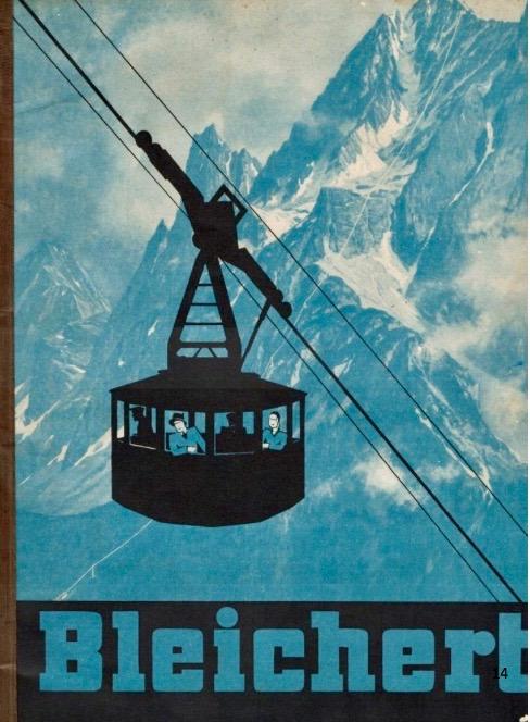
The Bleichert company had its headquarters in Leipzig and went through several name changes. Think about the Alps and need for cableways and ski lifts and hence the company dominated the aerial wire ropeway industry during the first half of the 20th century. Its cableways are to be found all over the world, in Argentina, Australia, Chile, France and Germany. This company also erected the Table Mountain Cableway (opened in 1929) and returned to refurbish and upgrade it in the mid 1990s.
Interwar Bleichert company poster for their cable cars (Bleichert Website)
The company came to Barberton responding to tourism interests as it was thought that the Barberton-Havelock cableway could be converted for passenger traffic. Their unequivocal response was an absolute no-no as it was not built for human transport. People apparently panic after 20 minutes of a cableway journey and some of the spans are so long that there would be a considerable amount of swaying. This cableway was only ever suitable for the transport of minerals. Of course they could try bungee jumps for extreme sports enthusiasts. The cableway is still there and we pass within a stone’s throw of it.
Darwin discovered sea shells on the peaks of the Andes and marvelled at how this was possible. Here on the Makhonjwa you can scoop up a handful of sea sand at the high reaches of the trail and see the ripples of the sea left on ancient beaches now petrified in the rocks.
At the intermittent stopping points on the trail are panoramic vistas where visitors can see the rock formations and the beautiful views. They are spectacular! At each view site there are detailed and lively info boards. The first stopping point looking back over Barberton in the valley is the Greenstone View. Then there is the De Kaap Valley View and the Tidal Sandstone View followed by the Eureka View and the Alluvial Conglomerate View. The road is steep, it twists and turns but is well made and well maintained. You can make the journey in an ordinary sedan car so you really don’t need a 4x4. Cycling uphill would be a challenge but invigorating!
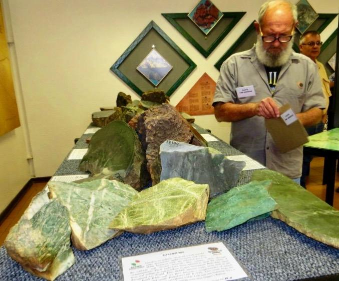
There are so many unusual minerals in the area – for example, stichtite or verdite. I enjoyed the passion of our geologists. They know the area inside out and their enthusiasm is infectious. Of course the geologists who favour preservation are confronted by all sorts of issues including land claims and mining companies opposed to a more managed ecotourism approach. Thankfully Tony and his team persisted to secure World Heritage Site status. We do have some incredible people in South Africa.
Tony Ferrar on tour (Kathy Munro)
The Geotrail ends at the Swaziland border. If you wish (and here you would need a 4x4 and your passport) you can cross the border and proceed to Bulembu (formerly the Havelock Mine village). One person on our tour commented that the next 20 kms within Swaziland takes about 2 hours. This was our turnaround point for the trip back to Barberton. A good tip is to split your stops at the view and information points between the outward and the return journeys.
There is a useful bibliography at the end of the book for further reading. This guide book has the rare distinction of making accurate scientific information accessible. It gives us the best of scientific tourism and you end your journey with perhaps the hint of a few answers to all those deep questions about life and its origins.
2018 Guide Price: R120 available at the Barberton Museum, 32 Pilgrim St Barberton, tel 013 712 4208 or Barberton Tourism: astrid@barberton.co.za
Studying the volcanic lapilli rocks on the Geotrail (Kathy Munro)
David Van Niekerk discusses some of the minerals from the Barberton Greenstone belt on display in the Barberton Museum (Kathy Munro)
Below is a list of all those involved in the UNESCO nomination. Thank you to Chris Rippon for supplying these details.
- DEA (Department of Environmental Affairs) – the late Minister Edna Molewa.
- DEDT (Mpumalanga Department of Economic Affairs and Tourism) – MEC Skhumbuzo Kholwane
- MTPA (Mpumalanga Tourism and Parks Agency) – Mr Louis Loock
- BCOB (Barberton Chamber of Business) – Executive Committee Members led by BCOB President Nico Oosthuizen.
- BATOBIC (Barberton Tourism and Biodiversity Corridor) – Mark Ngwenyama (Acting Programme Manager & Relationship Manager – led the community and stakeholder facilitation) and Danita Stott – Finance and Admin Manager. Concession Creek: Dr Dion Brandt (Geologist); Tony Ferrar (Ecologist & Parks Planner), Marliese Liebenberg (Archaeologist); Phumelele Mashele (Geologist) and Batobic for the completion of the nomination dossier.
- Prof Christoph Heubeck , not a member of the direct team, played a supporting role as the geologist who was the go-to-guy when seeking verification of correctness of information.
- SAHRA (South African Heritage Resources Agency) – Nkosazana Machete & Heidi Weldon.
- Prof Guy Narbonne Queens University, Canada who was the evaluation mission leader, representing UNESCO’s IUCN.
Kathy Munro is an Honorary Associate Professor in the School of Architecture and Planning at the University of the Witwatersrand. She enjoyed a long career as an academic and in management at Wits University. She trained as an economic historian. She is an enthusiastic book person and has built her own somewhat eclectic book collection over 40 years. Her interests cover Africana, Johannesburg history, history, art history, travel, business and banking histories. She researches and writes on historical architecture and heritage matters and is well known for her magnificent book reviews. She is a member of the Board of the Johannesburg Heritage Foundation and is a docent at the Wits Arts Museum. She is currently working on a couple of projects on Johannesburg architects and is researching South African architects, war cemeteries and memorials.

