Disclaimer: Any views expressed by individuals and organisations are their own and do not in any way represent the views of The Heritage Portal. If you find any mistakes or historical inaccuracies, please contact the editor.
We are honoured to publish this wonderful archive piece on the early history of Uitenhage. It was compiled by well known heritage practitioner Albrecht Herholdt and apperared in the 1988 edition of Restorica, the journal of the Simon van der Stel Foundation (today the Heritage Association of South Africa). Thank you to the University of Pretoria (copyright holders) for giving us permission to publish.
Uitenhage developed from 1804 to 1910 from a settlement with a typical Dutch Layout popular in the Cape Colony at the time of the founding of Uitenhage - of broad streets, water culverts and widely spaced thatched houses situated on the street edge, with all the official buildings located in a narrow stretch in one street, to a semi-industrialised town, densely developed in places, the streets lined with trees, dominated architecturally by British trends, with the public buildings and shops more evenly spread out and the skyline punctuated by the Victoria Tower and a number of church spires.
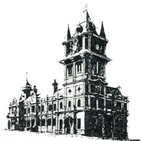
Victoria Tower (sketch by Kobus du Preez)
Uitenhage is the second oldest town in the Eastern Districts of the Cape Colony. Its founding was only surpassed by that of Graaff-Reinet 18 years earlier. For easier reference, the history of Uitenhage from 1804 to 1910 is divided into 3 phases. The three divisions are 1804 - 1841, 1841 - 1875 and 1875-1910.
Many events led to the founding of the district and town of Uitenhage in 1804. The 5 main reasons for this included the extensive size of the Graaff Reinet district of almost 30 000 square miles of which Uitenhage up to now formed part which made a new administrative border district a necessity. The continuous unrest on the eastern border also underlined the importance of a new centre for maintenance of law and order. Other reasons included Uitenhage's location so close to the strategic Algoa Bay, the social and moral decay in the district of Graaff Reinet caused by the lack of sufficient numbers of religious leaders and teachers as well as the requests of the inhabitants for the formation of another border district.
The Period 1804-1841
On 7 February 1804 Commissioner General J. A. Uitenhage de Mist after whom the town was named founded the district of Uitenhage, splitting the district of Graaff-Reinet into 2 parts. Captain Lodewyk Alberti - the commander at Ford Frederick was instructed to find a location for the establishment of a drostdy and town, and chose the farm of Widow Scheepers in the Zwartkops River valley at the foot of the Winterhoek Mountains. The size of the farm was 3 000 morgen and Alberti reported that:
"het midde van de plaatz leeverd, behalven het nodige Terrein voor die Drostdy en die daartoe behorende gebouwen en Tuinen eene volmaakt gunstige geleegentheid tot het uitgeven van Erven en het aanleggen van eene aanzienlikje groot Dorp op."
It also met the other requirements set by De Mist of a central location in the district, running water, enough trees for timber, fertile soil and ease of defence (it was only 6 hours away from Fort Frederick). Lichtenstein remarked in 1804 that:
"the country about the Zwartkopsriver truly deserved the attention of the Government, and it was wisely allotted as the seat of the Drostdy and village which are to form the centre point of the new district of Uitenhage."
And for many reasons Alberti did indeed make an excellent choice. Officials and travellers continued to praise the enviable natural advantages of the town, even more so after it acquired a reliable and abundant source of water from the springs. La Trobe (1815) and Steadman (1835) were impressed with the picturesque setting of the town on the bank of the Zwartkops River and the constant supply of water. The climate was regarded as so healthy that Cape Town patients were recommended by their doctors to recuperate there. Owing to these natural advantages and its close proximity to the important Port Elizabeth harbour, Uitenhage was, after 1823, repeatedly named as the capital of the Eastern Districts by some of the organisers of the Separation Movement (1823 - 1878). Should this movement have succeeded the capital may well have been removed from Cape Town to Uitenhage. Such a change was recommended by numerous officials, politicians etc. including Governor Janssens in correspondence of 1804; a Commission of Enquiry (1826); Governor Benjamin d'Urban (1834- 1835); Sir Henry Pottinger and Sir Andries Stockenstroom; Banbury (1838) who was a member of Governor Napier's party visiting the Eastern Cape; J.C. Chase in his "Cape of Good Hope and Eastern District". published in 1843; Lieutenant Governor H.E.F. Young (1847) and John Paterson. Paterson wrote a booklet which he called "A Dissertation on the Absolute Necessity of Resident Government in the Eastern Province of the Cape of Good Hope" in 1851 and gave it the amusing sub-title of "With an article on the eligibility of Uitenhage, as the site pointed out by nature herself for the seat of the supreme power in British South Africa".
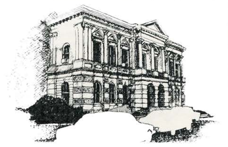
He set out to promote the advantages of Uitenhage with this publication and stated - amongst other favourable factors - that there was sufficient building area available to cater for the needs of a town with a population of 50 000. This idea was cherished for a long while after for when their Town Hall was completed in 1882 some of the speeches delivered at the opening ceremony showed that Uitenhage had still not lost hope of becoming the capital city of the Cape Colony. Joseph Reid M.L.A., said that the Town Hall could well be adopted for the House of Assembly and the large rooms upstairs for the Legislative Council. Upon this the Mayor of Port Elizabeth, Mr W.H. Pearson, very diplomatically commented that should the Parliament sit in Uitenhage, the government could well supply their own buildings.
Town Hall (sketch by Kobus du Preez)
The main rival for the position was Grahamstown (and later even King William's Town) which however lacked the natural resources of Uitenhage and was also far removed from Port Elizabeth.
When Alberti laid out the town, his military background clearly showed in the army camp pattern of the plan - static, symmetrical and lacking in inspiration. The Drostdy was geometrically and figuratively the centre of the town, because the boundary of Uitenhage was determined as a square with its centre on the Drostdy steps. A remarkable aspect of the design as pointed out by Lewcock was that the Drostdy farm (always attached to a Drostdy to allow the Magistrate to supplement his meagre salary) was also placed in the heart of the town, directly in front of the Drostdy, thus precluding the possibility of the main administrative buildings having a more than theoretical visual relationship to the built up area. This also prevented development from taking place in the southern quadrant of the town for a long time.
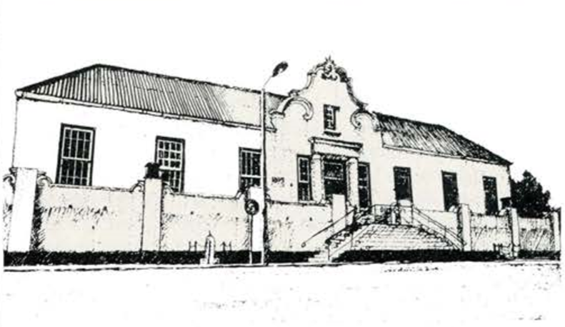
The Drostdy (sketch by Kobus du Preez)
Initially only 4 streets were laid out: Cuyler, John and Baird Streets intersecting at right angles with Caledon Street. In typical Cape Dutch fashion the streets were very wide and a hierarchy of roads existed, with Cuyler and Caledon Streets being the main thoroughfares, each 150 feet (45,7 m) wide - which was equal to the width of an erf and wide enough for an oxwagon to do a u-turn. Baird and John Streets, the secondary roads, were both 75 feet wide (22,9 m).
The site of the new town sloped gently upwards from the river to the underside of a hill. Caledon Street was set out more or less parallel to the flow of the Zwartkops River. This arrangement meant that true north orientation for any building was made impossible (unless such a structure was swayed on its site which almost never occurred during the 19th century), because the grid was plotted at an angle of 38C east of north. At the same time. the river remained a barrier preventing residential development from taking place on the other side of it during the whole of the Colonial Era.
To encourage people to settle in the new town the plots (of 1 morgen) were initially offered free, on the condition that they be built on within 6 months. The rules were changed after the British Occupation in 1806 to a price of 30 rix-dollars per plot with a clause pertaining to building within 18 months. After 1814 plots were sold to the highest bidder at a public auction. Progress was slow and by 1813 only 31 plots were sold and about 20 houses erected. All the buildings were concentrated in Cuyler and Caledon Streets.
In the meantime an immediate effort was made to erect the necessary government buildings for the administration of the new district which included the Drostdy (1804 - 1809), Prison (1811-12), Court House (1813-15), Messenger's House (1813 - 15) and House of the Secretary (1813- 14), all in the Cape Dutch style. It is remarkable that all these buildings were located on the upper side of Caledon Street resulting in a curious frontal character in the setting of the public buildings, looking down onto the houses to the south west.
An early description of the town comes from the pen of La Trobe who wrote in 1815 that:
"Uitenhage presents itself pleasantly with its few white houses, and the mansion of the landdrost, at the foot of a range of low hills"
A sketch made of Uitenhage in 1819 reveals that by that year almost 50 houses were completed and that the buildings had spread to both sides of Baird Street. The general appearance of the town was still that of a village with isolated buildings scattered over the place with few, if any, trees. The dwellings were without exception thatched and of a modest nature, and all were positioned on the street edges with large gardens at the back, many erfs stretching the whole length of a street block.
Progress on religious and educational matters were equally slow, especially with regard to related buildings. A temporary church, for the Dutch Reformed community, was completed in 1811, which also acted as a school building during the day. The London Mission Society's services for coloureds also dated from this time, and they completed the Rose Lane Church in c 1834.
The first "school building" dated from 1814, and in 1823 the government established a school for coloured people, held in the government buildings. Several private schools came into being and in 1840 the government school for boys was established- but still no proper school buildings existed.
After many of their farming activities failed and especially after the devastating floods of 1823, the 1820 Settlers drifted back to towns in the Eastern Cape, mainly to Grahamstown, but also to Uitenhage.
The Settlers brought with them the English ideas about architecture which differed markedly from the local Cape Dutch style, and after their arrival their Georgian tastes became more and more visible in the town's buildings. Sometimes the two styles were mixed, which produced an interesting fusion of ideas.
By 1828 new districts were formed, reducing the size of the Uitenhage district. Albany and Somerset now formed the Eastern border.
In 1829 another important development for the town took place when the springs on the farm Sandfontein, situated above the town and 8 km from it, were bought by the government and added to the commonage of Uitenhage. The town was now ensured of a reliable and abundant source of water of 1 700 000 gallons per day produced by the 20 different eyes of the springs. Slowly the effects of the easy availability of water showed in the greening of the town and several travellers and writers commented on the trees and plants of Uitenhage, which later became known as the Garden Town. This water source also enabled people to make a living from their vegetable and fruit gardens, while the water culverts on every side of the street gave the town a calm pastoral feel.
In 1834 Durban Street was already in existence and inhabitants had built several houses below Durban Street towards the river. Dwellings were also erected on the town side of Market street. By now the British influence on the architecture was even more visible which led Backhouse, who visited Uitenhage in December 1838 to comment:
"Uitenhage . .. is a pretty, Englishlooking town containing about 315 houses..."
Georgian architecture was by now firmly established and until the 1870's the box-like products of this style were being erected on sites all over the residential area of the town. Whereas the Cape Dutch dwelling was positioned on the street edge, the Georgian counterpart was often pushed back on the site to allow for a front garden.
By the year 1841 Uitenhage had thus developed into a small town, with a population of 1 900 whites and a total population of 2 050. It possessed the necessary buildings for the administration of the district, all lined up in one street, a variety of houses in the Cape Dutch and Georgian styles of architecture and fulfilled the function of a town servicing an agricultural community.
The Period 1841 - 1875
This period in the history of Uitenhage started with the proclamation of Uitenhage as a municipality on 5 June 1841. The town was divided into 5 wards and governed by 5 elected commissioners.
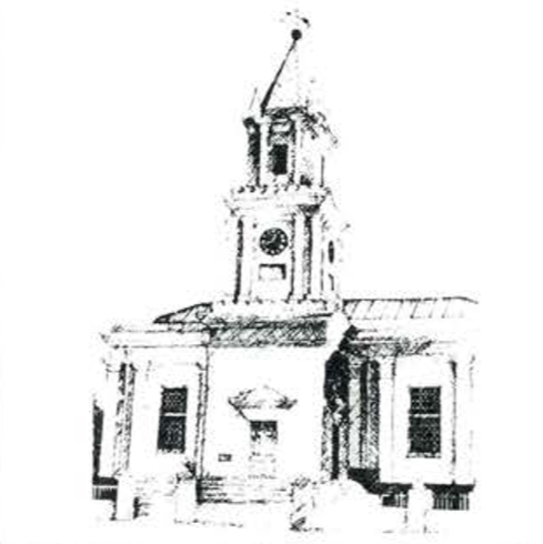
Another important event that happened 2 years after this was the completion of the Dutch Reformed Church. At last, after the building process, started 27 years earlier, it was inaugurated on 27 August 1843, reinforcing the domination of Caledon Street over the rest of the town. The Church, which showed Georgian influences in the neo-classical design, was situated at the T-junction of Caledon and Baird Streets and the tower, just over 27 m high, became the visual centre point of the village. Another aspect of the town's appearance was changing when luxurious trees began relieving the bareness of the town's layout.
Dutch Reformed Church (sketch by Kobus du Preez)
The year 1843 was eventful for another reason: the first wool washer F.H. Lange, erected his factory on the river side. This move could today be regarded as the first step towards the establishment of an industrial base for Uitenhage and the woolwasheries were to play an important role in the future of the town. Lange's example was followed by Peche in 1846, Christian Heugh and John Lear in 1849, C. Niven in 1861, Marshall & Appleby in 1865, Thomas Witheridge Gubb (Riverside) in 1866, and Henry William lnggs in 1867 (Springfields).
The extreme softness of the Zwartkops River water was the very reason that made Uitenhage's reputation as a woolwashing centre. "Uitenhage's Snow White" - as the washed wool became known - was internationally renowned and the town became the main centre of woolwashing in the colony. By 1875 10 woolwasheries were established near the town with a capital investment of £200 000. About 100 000 bales of wool were washed annually and exported through the Port Elizabeth harbour. In addition to extensive steam machinery a high number of unskilled labour was employed in the washeries.
Apart from the closing years and the growth of the woolwash industry the period 1841 - 1875 was not an era of great progress for the town. Hampered by the rapid expansion of Port Elizabeth and Grahamstown, development was slow and Uitenhage acquired the nickname "Sleepy Hollow". The following statistics reflect this slow progress:
In 1846 Uitenhage comprised 354 houses and immovable property to the value of £67 000 . By 1860 the town had expanded to Van der Riet Street, and Baines Road, and the first houses were built in Cannon Road. To the south east the land was subdivided in Stow Road and Magennis Street (although both did not exist then), and in the south west, the first buildings were built beneath Mitchell Street.
In 1864 the value of rateable buildings had risen to £112 000 and the population to 3,342. Over the next 10 years the growth of the population was less than 400, and there were 408 houses and 230 huts in the town. The value of fixed property for 1874 was £172,633. Thus from 1841 to 1875 the population increased by less than 1 700, the houses (including huts) by about 300 and the value of rateable buildings to just over £100 000.
Although Georgian architecture still reigned supreme, the first signs of the emerging Victorian aesthetics were already becoming visible in some of the new houses and churches erected.
Progress with religious and educational buildings was slow. The different denominations were still very small and did not have the resources to afford their own church buildings. Apart from the Dutch Reformed Church, who built the only substantial church during this period, other denominations used temporary accommodation, converted dwellings, or small expandable churches such as St Katherine's Anglican Church (1867 - 76) and the Wesleyan Jubilee Chapel (1870- 71). Victorian influences showed clearly in the Gothic Revival characteristics of these places of worship.
No specialised school buildings existed: The only public schools were the Government School (1840 - 1872) and the Uitenhage Proprietary School (founded in 1865 and which later became Muir College).
Two events of the 1870's led to the rapid expansion of the residential area of the town. The first of these was the coming of the railways. The first sod of the new line between Uitenhage and Port Elizabeth was turned in Port Elizabeth on 9 January 1872 by the Governor of the Cape Colony, Sir Henry Barkly, and it was opened for traffic on 21 September 1875.
The second event that led to the expansion of the town was when the municipality decided to sponsor the building of a new school for the Uitenhage Proprietary School (Muir College). In order to raise the necessary money, 33 morgen (20 acres) of ground, which became known as the College Hill lands, were sold in 1874 for £2 500 to individual bidders, the necessary government approval having been obtained. The area stretched northwards from Park Avenue to Baines Road, between Cannon Street and High Street and was a large addition to the residential area, although most of it remained undeveloped for many years.
At the close of this period in Uitenhage's history - just before the opening of the railway line - the one-sided development of the town was at its worst as the following contemporary description clearly reveals:
"Caledon Street ... contains about thirty stores or offices, many of which are large handsome buildings, and are occupied by wholesale merchants and importers, who do a considerable trade with farmers of the extensive district. In the same street are also the Dutch Reformed Church, Anglican Church (sic), Native Church and Schoolroom, Malay Mosque, Public Library, Dutch Reformed School, Government school, Native Government school, town offices, gaol, Court House, Drostdy, three hotels, and several smaller shops, private residences etc. This comparative concentration of trade to one street has caused the less populated parts of the town to fall into neglect so that in winter it presents a rather dilapidated appearance, but in spring, when the numerous trees burst into leaf and blossom and the hedges are covered with roses, the aspect of the place fully merits the description we have quoted and the appellation "Garden of the Eastern Province" by which it was long known."
The Period 1875 to 1910
The character of the town was to change drastically during the last period of Uitenhage's colonial history. The opening of the railway line on 21 September 1875 began the period. It was during the same year that temporary workshops for the Midland Railway System were built in the town followed by permanent ones in 1876. The establishment of the workshops in Uitenhage was of tremendous importance to the town and it remained the town's single most important industry for the rest of the Colonial Era. In these workshops coaches were built and locomotives repaired. The population and consumer power of the community greatly expanded when large numbers of English mechanics, appointed to jobs at the Workshops, and their families settled in the town. An immediate rise in the price of consumer goods was experienced, as well as a scarcity of labour and a high demand for houses. Three years after the introduction of the workshops, the rateable property in the town increased by nearly a third, and this excluded the workshop, stations and cottages erected by the Railway Department. It was estimated in 1885 that 300 white men were working at the workshops, and that with their families they totalled 700 people. Twenty-two semidetached houses were built by the railway authorities for workers, 19 by workers themselves and the rest lived in rented accommodation. The estimated investment made in the buildings and machinery was £240 000 which rose to nearly £700 000 in 1903. In that year the wages alone amounted ·· to £11 000 per month. The water bought by the railways from the municipality for the running of the workshops became a handsome income for the council.
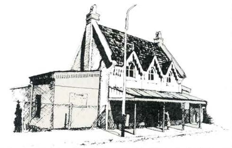
Railway Station (sketch by Kobus du Preez)
Although the establishment of the workshops in Uitenhage led to a sharp increase in population, assessable property etc., this collective prosperity did not mean general individual affluence. The phenomenon was illustrated by the many lower worker class houses built since then, and the absence of a large number of residences on the other end of the scale. The town attained a semi-industrial character and in 1907 Uitenhage was described as reminding:
" ... one of an English · workingman's town, for at knocking off time a thousand grimy workmen may be seen in work attire returning from labour ... "
In 1877 another important step forward for Uitenhage was taken when an act was promulgated, incorporating the town as a borough and creating a Town Council.
Immediately the pressure for the erection of a proper Town Hall increased and the building was eventually completed in 1882.
Apart from providing proper accommodation (including a library and reading room), the erection of the Town Hall was significant for 2 further reasons, the one being the choice of site and the way the building was placed on it. The location of the building at the lower end of the "Park" facing Market Square, meant that the concentration of all the public buildings in Caledon Street finally was done away with. The Railway Station, St Katherines and now the Town Hall were all situated in Market Street and reinforced the commercial activities that occurred in this street turning it into an important shopping precinct in Uitenhage.
The other reason why the erection of the Town Hall was important was, as already mentioned, the method of financing the Town Hall. The Council sold off parts of the town commonage and thereby significantly increased the residential area of the town. The "Town Hall" lands were sold in several stages. The area of the town divided into plots extended so rapidly that in 1883 it was necessary to name 25 new streets.
Other extensions - not connected to the building of the Town Hall - also occurred.
The rapid expansion of the town since 1875 coincided with a period during which Victorian influences on architecture dominated, leading to a Colonial version being developed in the Cape Colony towards the end of the nineteenth century. At the same time many older buildings were being "modernised" by the grafting on of typical Victorian elements. While the influence of Edwardian architecture was limited as a result of a depression being experienced in the town soon after the end of the Second Anglo-Boer War which caused the demand for houses and other buildings to subside, it was Victorian aesthetics that really made the biggest impact on the town's image. The verandah became the one element universally employed in all domestic architecture ranging from the most modest dwelling to the imposing villa. In typical Victorian fashion all attention focused on the street elevation(s) of buildings.
The large expansions in the residential areas led to a differentiation in the new living environments. The area around the Railway Workshops for example became a typical lower working class "suburb" with the houses densely packed on small sites, little variation in basic plan forms, tiny or no gardens to the front with many homes erected by speculators.
The more wealthy bought sites that were near to or which enabled them to overlook Magennis Park. These sites, located on College Hill and Cannon Hill, offered beautiful views of the town and surrounding landscape. The houses erected here, some of which were architect designed, were well set back on large sites, planted with exotic plants.
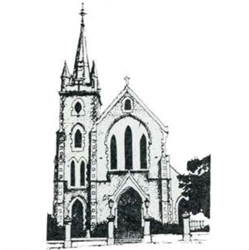
Great improvements also occurred during this period regarding municipal services for the town which had an important influence on the quality of life and the image of the town. For the first time parks were created while major progress was experienced in religious and educational matters. Most of the churches built during the period 1841 - 1875 were greatly enlarged between 1875 and 1910, viz. St Katherines Anglican Church (1896); the Wesleyan Jubilee Chapel (1889) and the Rose Lane Chapel (1886 and 1905). Two new churches were also built: the Congregational Church (1884 and extended in 1897 and 1905), and the impressive St Joseph's Roman Catholic Church (1899). In every instance, the architects concerned used the Gothic Revival style, so favoured during Victorian times for religious buildings. By carefully siting the churches on erfs facing onto major roads, these edifices greatly enriched the townscape of Uitenhage.
St Joseph's Roman Catholic Church (sketch by Kobus du Preez)
A great number of new schools and educational buildings dated from the period under discussion, and included Riebeeck Girls College, (1877, new school built in 1896); Holy Rosary Convent (1887, school built in 1889); Marist Brothers (1884, buildings added to over a number of years from 1893); the Dolley Memorial School for both sexes (1890, school built in 1892); the Industrial School for poor white boys (1894 in converted buildings school extended in 1901 ); and Muir College (new school built in 1902-4 and 1906) and lastly the Innes Primary School established in 1908, which made it the seventh public school in Uitenhage. As was the case with the church buildings, the schools were also erected on prominent sites scattered throughout the town. Their sheer size alone and architects' involvement (in most cases) with their design allowed educational buildings to contribute in no small way to the changing image of the town.
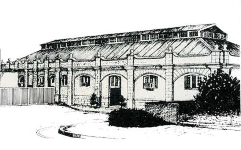
At last in 1898 the Public Buildings built shortly after the founding of Uitenhage were replaced by the new Public Buildings that included the Post Office, Court House and Magistrate's Office erected on the corner of Caledon and Church Streets. The tower, christened the Victoria Tower, was now the highest building in the town and it dominated the skyline of the town, together with the nearby tower of the Dutch Reformed Church. The increase in the number of inhabitants justified a new Library (1903), Hospital (1904), Market Building (1909) and Power Station (1910). Through private initiative a Horticultural Hall (1896), Drill Hall (1897) and Public Swimming Baths (1898) were erected, indicative of the growing diversity and sophistication amongst the population. The following statistics show the progress made in Uitenhage during the period 1875- 1910 regarding the population, number of houses and value of rateable property:
In 1875 the population totalled 3 693 which almost doubled in the next 15 years to 6 188 in 1891 (whites 3 183 and coloureds 2 905). During the following 10 years the population again doubled to 12 197 in 1901 (whites) 6 679 and coloureds 5 518). The census returns for 1911 however showed that the town's population dropped to 11 573 as people left the town as a result of the Depression experienced after 1904. In 1876 there were 429 houses in Uitenhage, which increased to 938 in 1889 and to 1486 in 1908. In 1908 the town also possessed 217 shops.
Power Station (sketch by Kobus du Preez)
Between 1875 and 1910 the situation regarding Uitenhage's other main industry - woolwashing - changed dramatically. In 1875 the 10 steam powered woolwasheries employed 800 workers. In the 1870's scab had spread throughout Southern Africa, and in order to control the situation the Scab Act No 31 of 1874 was promulgated, according to which, inspectors were appointed to ensure that farmers employ the recognised cure. Dipping the sheep in sulphur was compulsory which unfortunately severely influenced the quality of washed wool, and this resulted in a reduction in the number of woolwasheries in Uitenhage to 9 in 1883, while a tendency developed amongst farmers to ship wool to England in unwashed or "greased" form. More company owners sold their washeries, while costs rose and little new investment was made. The decline of the Uitenhage wool-washing industry, which treated about half of the £27 million of wool washed in the Cape Colony in 1891, was experienced elsewhere in the Colony and by 1904 only £6,6 million of wool was treated before export.
The Council, concerned about the undercutting of the town's role as an industrial centre, took steps to encourage the woolwashing business. These measures included the reduction of the amount paid for leases by the factory owners, but this was to no avail as more and more closed down. In 1904 two woolwashers, Gubb and lnggs, joined forces and founded the firm of Gubb & lnggs which later became one of the giants of the industry. They took over the last independent in 1911. After 1900 the Town Council tried to attract other industrialists to the town, but their efforts met with little success. In order to step up the campaign the Council decided in 1909 to advertise the Council's willingness to grant sites and water on exceptionally favourable terms to manufacturers who proposed starting industries in the town. The expectations of the Council were, however, only to be met later during the twentieth century.
This period in the history of Uitenhage closed with the formation of the Union of South Africa on 31 May 1910. By this time the transformation of the town was already long completed.
Comments will load below. If for any reason none appear click here for some troubleshooting tips. If you would like to post a comment and need instructions click here.

